This is our fucking city.  And nobody is going to dictate our freedom.  Stay strong.
– David “Big Papi” Ortiz, Boston Red Sox designated hitter

And with that, standing 15 miles and 238 years removed from the original, David Ortiz fired his own shot heard ’round the world.

Ortiz and his Red Sox teammates are icons of Boston sports culture.  But in his pregame address before the team took the field against Kansas City on Saturday, Ortiz was talking to a far wider audience than the 35,152 battle-tested fans in attendance at Fenway Park.

Because this past week, Boston truly was our city.  Boston was San Francisco’s city.  Boston was Chicago’s city.  Boston was Denver’s city, Miami’s city and New Orleans’ city.  Boston was even New York City’s city, as proclaimed by the “United We Stand” banner sporting dual Yankees and Red Sox logos that hung outside Yankee Stadium on Tuesday.

Over the course of a 102-hour period from Monday afternoon to Friday evening, we were barraged by thousands of graphic images of real-time chaos, tragedy and implausible strength.  We were warned to avert our eyes from some images, while being asked to look very carefully at others.  Thousands of pictures worth millions of words, as news agencies – including CNN with its bumbling, stumbling impression of a rabid dog chasing its tail – hustled to force-feed us those words and many more.  Meanwhile, those of us in the running community struggled to make sense of and assign words to our own swirling emotions.

Yet two words quickly rose above the turmoil: Boston Strong.  Two words worth a thousand pictures.  Two words to drive home the point that, as we approach our 237th birthday, each new terrorist threat to these States of America only serves to reaffirm and reinforce the fact that the U. remains an inextricable partner of the S.A.

With that in mind, and before this blog moves in a different direction, I wanted to share 10 unforgettable images and stories from a week that, to me, showcased and immortalized what it means to be Boston Strong:

Four we won’t forget
Krystle Campbell (29), Martin Richard (8) and Lu Lingzi (23) were killed in Monday’s bombings.  MIT campus patrol officer Sean Collier (26) was shot and killed in the line of duty by the Tsarnaev brothers on Thursday.  Donations can be made to the Krystle M. Campbell Memorial Fund, the Richard Family Fund, the Lu Lingzi Scholarship Fund at Boston University, and under Officer Collier’s name to The Jimmy Fund:

KrystleCampbell_MartinRichard_LingziLu_SeanCollier

In addition, The One Fund Boston, Inc. has been established by Massachusetts Governor Deval Patrick and Boston Mayor Tom Menino to provide financial support for all those directly affected by the week’s tragic events.

Bill Iffrig and the bombing of Boylston Street (Monday)
Bill Iffrig (circled at top, and in orange tanktop at bottom) was seconds from finishing his third Boston Marathon when shock waves from the first explosion knocked him to the ground.  After being helped to his feet by a race official, the 78-year-old Washington resident finished the marathon under his own power.  Iffrig’s story has come to symbolize the city of Boston’s endurance and resolve in the aftermath of Monday’s madness:

Finish line_MS

© 2013 The New York Times Company

Bill Iffrig-Boston Globe

(AP Photo/The Boston Globe, John Tlumacki)

Jeff Bauman, hero (Monday)
Jeff Bauman was standing at the marathon finish line to cheer on his girlfriend when Tamerlan Tsarnaev dropped a backpack containing a bomb at his feet.  Despite losing both legs in the explosion and waking up in the hospital heavily drugged, Bauman (shown here being rushed from the scene by a paramedic and two volunteers, including Carlos Arredondo in the cowboy hat) immediately asked for a pen and paper on which he wrote, “bag, saw the guy, looked right at me.”  His subsequent identification of Tsarnaev was the breakthrough FBI investigators needed to finger Tsarnaev and his brother Dzhokhar as prime suspects:

Jeff Bauman

(AP Photo/Charles Krupa)

Man comforts bombing victim (Monday)
I don’t know whether they knew each other before Monday or whether this is their first meeting, but without question this is one of the most poignant images to emerge from the day’s harsh surreality:

Comforted

Détente in the Bronx (Tuesday)
As much as I hate to admit it, the New York Yankees are a classy organization.  New York’s show of solidarity with its normally bitter rival was on full display on the outer facade of Yankee Stadium before Tuesday’s game against the Arizona Diamondbacks.  The team recognized a moment of silence for the bombing victims, and the stadium’s PA system played Fenway favorite “Sweet Caroline” as fans sang along at the end of the third inning:

NYY07_BASEBALL

Four days later, the two cities set aside their similarities for 48 minutes as the Knicks defeated the Celtics in game one of their NBA playoffs series.  Don’t get cocky New York, it’s only one game.

Manhunt in the streets of Boston (Friday)
Boston residents were ordered to “shelter-in-place” as authorities pursued bombing suspect Dzhokhar Tsarnaev.  The lockdown left the streets of Boston and its surrounding suburbs eerily empty and quiet, as exemplified by this photo of Kenmore Square tweeted by Andrew Golden:

BIOajDVCYAETXOg

The Boston Police Department: “CAPTURED!!!” (Friday)
This tweet, time-stamped 8:58pm EDT on Friday April 19, says it all:

CAPTURED

It’s his f@&#ing city, too
He’s David Ortiz’s kind of kid: I’ve had this picture on my hard drive for several years now, and usually call on it to harass my friends once the baseball playoffs begin.  Before I get called out for my naïvete, yes I realize he’s a promiscuous kid and can be found online wearing pretty much any team’s jersey.  But to me the sentiment is so perfect and so… Boston, particular now, that this list wouldn’t feel right without him:

Red Sox fan

Boston Bruins fans sing “The Star-Spangled Banner” (Wednesday)
In the first professional sporting event in Boston since the bombings, Boston Bruins’ fans joined in and then overwhelmed Rene Rancourt as he sang the national anthem.  If this doesn’t bring a tear to your eye, or at least a gaggle of goosebumps to your skin, I can only assume you just awoke from a 102-hour slumber:

And I leave you with one final image, a collective sentiment that will continue to resonate with runners everywhere long after the debris on Boylston has been cleared away… after all, Boston is our fucking city:

o-RUN-FOR-BOSTON-570

The One Fund Boston, Inc. was established “to help the people most affected by the tragic events that occurred in Boston on April 15, 2013.”  Please give generously.

We’ll keep training harder, for the people who perished today.
– Wesley Korir, 2012 Boston Marathon winner

BAA logo

It shouldn’t have to be this way.

I was ready to publish a much different post today.  It was (and still will be) a post about my most recent marathon experience, a literal example of how I’ll go to the end of the earth and back for a sport I love.  Like a digital carpenter I’d plied the tools of the blogging trade in referencing the grueling workouts, the frequent ups and downs, the thrill of accomplishment, the rapturous sense of being a better person for having given everything I had to give for 26.2 miles.  But more than anything, I’d chronicled the camaraderie that emerges when a diverse collection of like-minded individuals strives toward and achieves a common goal.

But then, in a cruel twist of fate, it was that sense of camaraderie that got kicked in the gut by yesterday’s gruesome and tragic events at the 117th Boston Marathon, where two explosions near the finish line killed three people and injured at least 176 others.  And in seconds, all perspective changed.

Clearly running means a lot to me – I spend a lot of time sharing my thoughts on the sport and my involvement in it.  But the city of Boston is also ingrained in my constitution – my father was born and raised in Newton, MA, roughly 5 miles from the marathon finish on Boylston Street.  I’m a lifelong Celtics and Red Sox fan.  And despite The Onion’s recent decidedly Onion-like portrayal of Beantowners as “playing their adorable little game of ‘Big City’ “, Boston is a dynamic and storied place, and one of the few East Coast cities that doesn’t make me immediately want to leave.

So understandably, as I sat 3,000 miles away in the safety of my living room, a maelstrom of raw emotions gripped me in the aftermath of the bombings:

Sadness and empathy – for the three individuals who lost their lives for no other reason than that they were in the wrong place at the wrong time, and for all those directly affected by the wanton bloodshed of the day’s events.

Sadness, too, that nobody is talking about how Kenya and Ethiopia once again dominated both the men’s and women’s marathon, or how Americans Jason Hartmann and Shalane Flanagan captured strong fourth-place finishes.  Before 3:00pm EDT, I had to root around on the ESPN.com homepage just to find race results – ESPN was so disinterested that coverage of the WNBA draft trumped the marathon.  Thirty minutes later Boston was dominating the website’s headlines for all the wrong reasons, and suddenly my desire for more in-depth marathon coverage was perversely granted.  And now I long for the day when “explosion” isn’t the top choice among Google’s Autocomplete suggestions when I type in “Boston Marathon.”

Shock – at stark images of blood-strewn sidewalks and first-hand accounts from runners like Roupen Bastajian, a Rhode Island state trooper and former Marine who crossed the finish line just before the first explosion and then hurried to help other runners.  “These runners just finished and they don’t have legs now,” Bastajian said. “So many of them. There are so many people without legs. It’s all blood. There’s blood everywhere. You got bones, fragments. It’s disgusting. It’s like a war zone.”

Sympathy – for the entire city of Boston, whose distinctive pride and spirit – as embodied by their own distinctive holiday – should have been on full celebratory display yesterday in front of an international audience.

Violation – for the ravaged innocence of my sport and its flagship event, neither of which can ever get it back.  I don’t look forward to the new and perverted definition of normalcy that awaits us at future marathons.

Anger – at the (to this point) faceless cowards whose own misguided anger motivated such a senseless and unconscionable act of – just typing the word makes me angry – terrorism.

Finish line

© 2013 The New York Times Company

Shortly after the news broke I received concerned text messages from several friends wanting to make sure Katie and I were okay.  I appreciated their thinking I was fast enough to qualify for Boston, even though the closest I’ve come so far was the 5 miles I bandited during my brother’s 3:14:05 effort in 1998.

Nonetheless like most runners, I knew several people who would be among the select few racing in Boston this year.  My sister-in-law qualified this year and even registered for the race before deciding to sit it out.  Based on her standard marathon finish time of around 4 hours, she likely would have been finishing around the time chaos engulfed Boylston Street.

Several friends in this year’s race had already finished and left the Copley Square area before the bombings.  And another friend, whom I was fortunate to meet just last month, was leading a blind runner and had just passed mile 25.5 when the first explosion forced them off the course.  Fortunately for both him and his running mate, there will be other Bostons.  Not so for the 8-year-old boy and two others who were killed by the blasts.

It’s unclear at this point who is responsible for the carnage that dominated Copley Square in the latter stages of yesterday’s marathon.  It’s unclear whether they were targeting a particular person or group of persons, the Boston Athletic Association, the marathon event itself, Patriots’ Day as a symbolic holiday, or perhaps even the entire city of Boston.

But what is clear is that the sport of running is forever changed.  Not in the sense of big obvious changes such as beefed-up security at major events, though that will inevitably happen.  Rather, I worry about more subtle and insidious changes to psychology as doubt and hesitation creep in, replacing the easy confidence of some runners who find themselves racing in large crowded venues.  Am I really comfortable doing this?, they will ask.  Others who qualify to race in Boston next year may very well decline the opportunity.

It shouldn’t have to be this way.

I experienced September 11, 2001 with a sense of surreal detachment, as though like a movie all the events I saw unfolding on television would cease to be and life would return to normal as soon as I turned off my set.  I wasn’t directly affected on a personal level by the 9/11 attacks, and so honestly I always felt removed from the situation, like a zoo patron watching tigers feed from behind the glass.

But even though I still live in Northern California as I did then, Boston feels more personal.  Not only because of my history with the city, but because the running community really is an extended family.  If you don’t believe me, lose yourself for an hour in the intricately woven web of the running blogosphere.  Or check out the sheer number of “Team In Training” runners at your next local marathon.  Or spend some time with a group of Marathon Maniacs… you’ll wonder how you ever had fun without running 26.2 miles.

The runners who line up in Hopkinton and finish in downtown Boston 26.2 miles later are the best of the best.  The vast majority of them I don’t know and will never meet.  But as one who shares their passion, I understand and appreciate the sacrifices – not to mention the fartleks, hill repeats, tempo work, icing, stretching, compression and “vitamin I” (ibuprofen) doses – required of those who chase the elusive unicorn.

They’re tall, short, young, old, husbands, wives, sons, daughters, leaders, followers, Nike aficionados and Saucony loyalists.  They’re strange friends to some and friendly strangers to others.  They’re the elites I emulate, the bloggers I follow, the weekend warriors I cheer.  They’re all very different, yet very much the same.  And regardless of race, creed, age, gender, color, nationality, religion, disability, socioeconomic status, sexual orientation or even marathon finish time, they’re my people.  One nation, indivisible, with fast starts and strong finishes for all.

And so I can add to the list one more emotion that gripped me in the aftermath of Monday’s tragedy: Certainty.  Certainty that both the fiercely proud city of Boston and the equally strong-willed running community will rally together behind yesterday’s tragic events.  Certainty that an unambiguous message will be sent to those responsible, the message that after all the literal blood, sweat and tears we put into training for, qualifying for and preparing for this race; the tireless hard work and dedication we put year after year into maintaining the Boston Marathon as the oldest annual marathon and most prestigious organized foot race in the world; and the unwavering focus we put into doing things our own way – after all that, you think two bombs can demolish our dreams and deter us from our mission?

I look forward to proving you wrong.

My original post for today will appear in a few days.  In the meantime, the city of Boston and those of us who define ourselves as runners will slowly but surely return to life as usual.  For many – myself included – that life will continue to boast the same ambitious and overriding goal: to qualify for Boston.  And hopefully one day, all of us not-yet-fast-enough marathoners will again be able to say resolutely and without a hint of twisted irony, “I’d give my left arm to run Boston.”

It shouldn’t have to be this way.

BC&H will be on international hiatus from March 21-April 6, but I’ll look forward to catching up with everyone’s running exploits when I return.  In the meantime I wanted to re-blog the following… thanks to Jim Benton for creating and Bora Zivkovic at Scientific American for sharing it.  If there exists a legitimate use for the letters “LOL,” it’s here:
10yvf8m
And with that, the blog must go on… don’t forget to leave interesting and thought-provoking comments below!

*******

Two roads diverged in a wood, and I – I took the one less traveled by, and that has made all the difference.
– Robert Frost

Strategically, this 30-mile route traverses much of the greenery and scenery in the East Bay

If you read this blog with any regularity, then my preference for trails over asphalt is no dirty little secret (dirty yes, secret no).  I’ve even taken to running much of my speedwork on our local dirt track.  But even in the Bay Area, with its (appropriately) liberal trail system, roads are an unavoidable fact of life for most runners.  And although we prefer to shape it into eye-catching forms such as “international orange” bridges and the nicest baseball park in the country, concrete still dominates our urban landscape.

So it’s inevitable that most of my training mileage is logged on concrete.  This is particularly true during the winter (i.e. rainy) months, when trails become saturated and I’ll do anything to avoid running indoors on It-Which-Must-Not-Be-Named.  And sometimes embracing my inner asphalt junkie becomes equal parts necessary evil and training strategery, as when I’m prepping for a road marathon.  Nothing simulates the physical monotony of concrete quite like the physical monotony of concrete.

Fortunately in the Bay Area, running on concrete doesn’t have to mean flat and boring.  This is most important for the long slow distance (LSD) run that forms the backbone of the conventional marathon training regimen.  Through hours of repetitive foot-striking on unyielding paved surfaces, the LSD training run builds physical and mental endurance by strengthening tendons, ligaments and the will to persevere despite frequent stretches of soul-squelching boredom.

For me the downside of the LSD isn’t the physical toll exacted by running 20+ miles at a time; instead, it’s the monotony of stringing together sidewalk mile after sidewalk mile through residential neighborhoods and strip malls, pausing occasionally to stiffen up at traffic lights while looking forward to the next curb as a much-needed source of elevation change.

With scenery like this, maybe they should rename it the Wrought Iron Horse Trail

Granted, flat and boring do make welcome bedfellows at times, as when I want to regulate my pace for longer distances, say 15-16 miles.  In that case I retreat into an audiobook and hit the Iron Horse Regional Trail, a paved pedestrian and bike trail named (I presume) for how your joints feel after treading its 25 miles of concrete through nondescript East Bay suburbs – Now, Concord! now, Pleasant Hill! now, Walnut Creek and Alamo! On, Danville! on, San Ramon! on, Dublin and Pleasanton!  But even the Iron Horse Trail has its own smattering of stoplights and trafficky intersections to hinder a runner’s progress.

Alternatively, if you’re looking to slowly liquify your hip flexors without the dangerous risk of encountering new scenery, you can always resort to hammering out endless laps around one of the local 400m tracks.  And given the choice of the track or the treadmill, I figure a hip replacement or two later in life would be well worth the time spent outdoors now.

But on one recent weekend, feeling demotivated by the usual LSD suspects, I set out to take advantage of my surroundings and chart a LSD run that would be as un-flat and non-boring as possible.  And by non-boring I mean scenic, not frogger-on-the-highway-dodging-cars exciting.  My goal, which seemed improbable at the time, was to map out a scenic point-to-point course of 26 consecutive miles, entirely on paved surfaces, without a single stoplight.  I ended up with nearly 30.

As I did in mapping a 32-mile course on trails across the East Bay, I’ve included a blow-by-blow description of my 30-mile route below.  And in fact this route closely parallels that earlier 32-miler, the most notable difference being the terrain (asphalt instead of dirt).  Despite its length, this route isn’t brain surgery; on the contrary, most 19th-century lobotomy patients – and even someone with my non-sense of direction – could find their way to the end without much difficulty.  At the same time, rather than the typical flat and boring urban scenery, this course borders – and at times passes through – several of the East Bay’s excellent regional parks and preserves.

Views like this one accompany you along Grizzly Peak

Sweeping views of the Golden Gate Bridge and Marin Headlands predominate up on Grizzly Peak

It’s hard to get anywhere in Berkeley without an uphill component, so it makes sense that a 30-mile run would be no exception.  For some runners, the most daunting feature of the route won’t be its length, but rather its first six miles.  Starting at the intersection of Spruce St and Cedar St in North Berkeley, the course immediately chugs up Spruce two miles and then along Grizzly Peak four miles for a net uphill gain of 1,300ft.  Fortunately this first 20% of your day amounts to more “initial gut check” than “premonition of things to come,” as the course features a net elevation loss of 1,500ft over the next 24 miles.  So overall this is a downhill course – and if that doesn’t scream “Boston qualifier” (in an Edvard Munch sort of way), then you’re not listening.

As uphills go, Spruce-to-Grizzly Peak amounts to moderate effort for maximal gain – the views across the bay are awesome.  And as you continue your gradual but steady ascent along Grizzly Peak, adjacent to Tilden Regional Park, the panoramic vistas of San Francisco that greet you on a clear day also double as psychological (and unscented!) Bengay for your already-fatigued quads.

The course peaks at mile 6, at the southeastern edge of Tilden Regional near the entrance to the Steam Trains.  At this point Grizzly Peak reverses trajectory, heading downhill with the occasional modest uphill jag over the next four miles. On the edge of the Sibley Volcanic Regional Preserve, Grizzly Peak loses its bite and dead-ends into Skyline Blvd.  Bank a left turn, and Skyline winds its way along a more-or-less level course for the next two miles.  This is the ideal time to relax and settle into a rhythm as you navigate the Oakland Hills and soak in the views across the Bay.  Fortunately the views up here are pretty much all you’ll be soaking in, because while the sun on most days will join you, its heat rarely poses a problem at any time of the year.

As Skyline Blvd enters Huckleberry Botanic Regional Preserve, it begins a definite downward trajectory and morphs into Pinehurst Rd, which will host the next leg of your journey into Redwood Regional Park.  Six miles later, at the 18-mile mark, you’ll transition on to Redwood Rd as it exits Redwood Regional and enters Anthony Chabot Regional Park.  For the next five miles you’ll border Chabot on your right and the branching Upper San Leandro Reservoir on your left, before the former seamlessly transitions into its sister park, Lake Chabot Regional.

I usually share this route through the Oakland Hills with a steady stream of cyclists, yet surprisingly few runners.  Admittedly it does have its downsides for those accustomed to more urban running, but they’re relatively innocuous: 1) because sidewalks are scarce, I run primarily on the shoulder or side of the road; and 2) on occasion the winding course motivates me to zig and zag from one side of the road to the other, so I can stick to the outside lane and avoid startling an oncoming driver accelerating around a blind curve.

You may feel a bit uncomfortable initially if you’re new to these roads.  But being able to lose yourself in your surroundings more than makes up for the occasional hassle of having to pay attention to them.  Fortunately, the route is straightforward to negotiate and remains at two lanes for 26 miles, before widening and straightening out near its endpoint.

With that endpoint in sight, and as if to say “don’t let the door hit you on your way out,” Redwood Rd veers uphill one last time before putting Lake Chabot – and the relative solitude of the past 26 miles – in your rearview mirror and dropping you down into Castro Valley.  Welcome to the suburban world of fenced-in schools, sprawling single-story strip malls, fast food joints and closely juxtaposed homes with HOA-approved lawns, all laid out block after block in characteristic grid fashion.  Here at last you’ll encounter your first stoplight of the day, at Seven Hills Rd just past mile 27.  So maybe it wasn’t quite 30 miles to your first stoplight, but then again after nearly 100,000 steps, 4,100ft of elevation gain, 4,300ft of elevation loss and 3,800 calories burned at an average pace of 9:46 per mile… after all that, really who’s counting?

One more mile down Redwood Rd, one wide anticlimactic loop around the Castro Valley BART station, and all good things must come to an end (unless you opt to turn around and ride that endorphin high all the way back to Berkeley).  Nice job, foot soldier!  If 30 miles of feet pounding concrete and concrete pounding feet doesn’t prepare you both mentally and physically for your next road marathon, well then that was a dumb way to spend five hours you’ll never get back, wasn’t it?

Mike Sohaskey after running 30 miles

Happy as I’ll ever be to find myself in Castro Valley

If you had the foresight to bring a few dollars or a loaded BART card on your run, you can now happily collapse on the next available BART train to downtown Berkeley and disembark roughly ¾-mile from where your day began.  Sit at your own risk though, lest your train arrive at and depart the downtown Berkeley station while you’re still valiantly struggling to pull yourself upright like a member of the zombie apocalypse.

In reality, despite their tranquil vibe and off-the-beaten-path allure, I’m guessing very few people cover these 30 miles all at once.  After all, Highway 580 or even BART provides much more convenient and direct access to Castro Valley from most of the East Bay.  And I’m guessing most folks who do travel this route do so as transiently as possible, from the relative comfort and disconnect of a fast-moving vehicle – all while focused on not bouncing a turkey, deer or cyclist off their hood.

But I prefer the (literally) more grounded approach… because it’s gratifying to think that even here and even now, there still are roads less traveled.  Roads that, away from the watchful eyes of seven million Bay Area residents, don’t aspire to be ogled on TV, or friended on Facebook, or followed on Twitter.  Roads that breathe at their own pace.  Roads where silence is, if not golden, then at least not treated as fool’s gold.  Roads on which you can either lose or find yourself, depending on which direction you’re headed.  Roads that, in another time and another place, just might have been trails.  I’ve invested countless man-hours seeking out and following these roads where they lead.  On foot.  As a runner.

And that’s made all the difference.

FINAL STATS:
Total distance: 30 miles (with no unplanned detours)
Total time: 4:53:18
Average pace: 9:46/mile
Elevation change (Garmin Connect Software): 4,076ft ascent, 4,278ft descent

Blow-by-blow directions for my 30-mile route from Berkeley to Castro Valley

Blow-by-blow directions for my 30-mile route from Berkeley to Castro Valley

Well done is better than well said.
– Benjamin Franklin

Sunset on the Bay Bridge, with San Francisco aglow in the background (original photo here)

18 February 2013

Dear Bay Area Toll Authority,

It’s not often I write an open – or for that matter a closed – letter to a government entity.  It feels too much like yelling at the TV.  But just this once I thought I’d make an exception… because as a current East Bay and former South Bay resident, I have a long-overdue plan to help ensure the San Francisco-Oakland Bay Bridge – with its new eastern span to be completed later this year – is the architectural marvel and civic masterpiece it deserves to be.  Besides, isn’t speaking up and making my voice heard the mark of a good Bay Area resident?

Don’t worry, I’m not writing to take you to task – as many Bay Area residents already have – for the project’s staggering and ever-escalating price tag (currently estimated at over $12 billion, making it the most expensive public works project in California history), nor for the fact that design and construction of the bridge’s Self-Anchored Suspension Tower has been outsourced to at least seven countries, chief among them China.  Though admittedly, these would provide solid starting points for a discussion of California’s enduringly inept bureaucracy.

Nope, I’m writing to you today as a runner, one who’s spent countless hours exploring the Bay Area’s myriad roads and trails on foot.  Fact is, the Bay Area’s calling card is its geographic, cultural, ethnic and socioeconomic diversity, and running provides ready access to that diversity as no other mode of transport can.  So my ongoing issue with the Bay Bridge is one not of unchecked excess but of glaring omission.  It’s a first-world problem, but here in the pedestrian-friendly Bay Area it’s also a conspicuous oversight.  It’s the lack of a Bay Bridge pedestrian/bike path extending from Oakland to San Francisco.

GG Bridge from Bay Bridge

It makes me blue to think that this view – shot from the Bay Bridge at 50 mph – is inaccessible by foot

Do you know what the East Bay, North Bay, South Bay, and City by the Bay all have in common?  It’s not a trick question.  The San Francisco Bay separates east from west, Oakland from San Francisco, A’s fan from Giants fan, Raiders fan from 49ers fan, future Warriors fan from former Warriors fan, and foggy from, well, foggier.  Several months ago, while the 49ers were flexing their muscles and the Raiders were regularly getting sand kicked in their face, the cheeky response to the question of “What separates the NFL’s best and worst teams?”  would have been “the San Francisco Bay.”  But as divisive as five miles of water can be (particularly during football season), it’s the Bay Bridge that physically connects and otherwise unifies the two sides of the bay.  Unless, of course, you’re on foot.

Granted, both Bay Area Rapid Transit (BART) and an inconvenient ferry system operate between Oakland and SF.  But as Bay Area residents we pride ourselves on our progressive joie de vivre, particularly as regards our spectrum of eco-friendly transportation options.  I see more hybrid vehicles at a typical stoplight here than I see during an entire week in most other states.  Bike lanes are a staple of our commuting diet, and out-of-town guests are constantly amazed by the pedestrian-savvy temperament of the drivers here.  From my home base in the East Bay, I feel like I can get pretty much anywhere I want to get in the San Francisco Bay Area on foot.

Except San Francisco.

The fact that I can’t run directly from Oakland to San Francisco is absurd.  Currently all my runs along the Berkeley Marina end by necessity on the border of Emeryville, at the eastern end of the Bay Bridge.  From there it’s either head back up the Marina the way I came, head east into Emeryville (which without Pixar would pretty much qualify as Oakland’s appendix), or gaze longingly across the bay at a vast running landscape that in those moments of frustration might as well be the Emerald City.  Except that – OOPS! – we forgot to build a yellow brick road.

Artist’s rendering of a Bay Bridge pedestrian/bike path… look how much fun those faux people are having!
(photo © 2011 Rmleczko, courtesy MTA)

Why has a Bay Bridge pedestrian and bike path not yet happened?  It’s unclear why its original architect – unlike the architects of its more popular and flamboyant neighbor, the Golden Gate Bridge (GGB) – failed to prioritize pedestrian access in his part-suspension, part-cantilever design.  This oversight is even more puzzling given that initial construction on both bridges began six months apart in the same year, 1933.  It’s hard to imagine that two groups of architects, each working on its own similarly massive engineering project, could operate in such close physical proximity without swapping stories or sharing ideas.  In any case, since opening in May 1937 the GGB has boasted pedestrian walkways on its eastern and western sides.  On pleasant days these walkways are crowded with sightseeing tourists and smitten locals, around whom I’ll dance and weave as I hoof my way from the Marin Headlands to all parts of San Francisco.

True, the new Bay Bridge eastern span leading from Oakland to Yerba Buena and Treasure Islands will contain a pedestrian/bike lane, a fact that former SF mayor Willie Brown is quick to take credit for.  Inexplicably, however, there are no plans to extend pedestrian access all the way to SF.  This feels like popping a handful of M&Ms in your mouth, only to discover after your first chew that they’re actually Skittles – great expectations give way to visceral annoyance gives way to resigned disappointment.  It’s a bewildering lapse in both planning and judgment that’s earned the new walkway the derisive nickname of “bike path to nowhere.”  Try not to take it too hard, Treasure Island.

From a busine$$ perspective, I’m envisioning the commercial applications for a Bay Bridge pedestrian/bike path.  This past week, Matier and Ross reported in the SF Chronicle that a 12.5-mile run from Oakland City Hall to SF City Hall is in the works as part of the opening weekend festivities for the new bridge.  It’s a terrific idea, but why stop there?  Add another half mile to the course, and what Bay Area runner wouldn’t sign up and line up to run the annual “Hall to Hall” Half Marathon to benefit Oakland and SF charities, with the incentive of an additional donation (plus bragging rights) going to the city with the fastest runners?  The walkways on the Golden Gate Bridge figure prominently in three current SF races – the U.S. Half, the newly rebranded Rock ‘n’ Roll San Francisco Half, and the 200-mile Golden Gate Relay.  Plus the city’s signature event, the Wipro San Francisco Marathon, runs on the GGB roadbed.  There’s no reason the Bay Bridge couldn’t (and shouldn’t) follow suit.

I’m happy to design a Bay Area-savvy medal for the “Hall-to-Hall” Half Marathon

I expect your higher-ups at the Bay Area Toll Authority will be quick to cite financial constraints and design considerations, and to suggest that I get in line behind everyone else’s pet projects.  But that’s why I’ve addressed this letter to your agency – because you have the authority (the word’s in your name, after all) to “fund the long-term capital improvement and rehabilitation of the bridges.”  And given that the Bay Bridge east span replacement is already grossly over budget – a budget that has been alarmingly immune to public scrutiny – what’s another half a billion dollars among friends?  You’ll likely spend a solid chunk of that on Labor Day opening ceremonies anyway.

I’m encouraged to read that finally we’ve reached the stage where a Bay Bridge pedestrian/bike path is now an official project eligible for funding.  But you and I both know that’s government-speak for “we’ll get to it when we get to it,” and unless the project shows up on someone’s priority list soon, it will remain without funding ad infinitum.  In the meantime, while the relevant “project initiation document” sits gathering the sloughed-off dead skin of feckless government officials dust in a file cabinet in Sacramento, think about the vital opportunity the Bay Area is losing to improve traffic flow and further reduce carbon emissions by increasing the number of commuters biking (or even running!) to work.  And running or biking is more affordable than riding BART or taking the ferry.

Since we the taxpayers are obligated to foot the bill for Bay Bridge reconstruction, then we should also be able to foot the Bay Bridge.  A two-way pedestrian and bike path should have happened years – nay, decades – ago.  Yet somehow, here in the nation’s crown jewel of progressive foresight and ingenuity, I can still swim from Oakland to San Francisco faster than I can run.  So come on BATA, let’s get this done!  Do the right thing and don’t drop the ball on this one.  We both know the Raiders don’t need the competition.

Best regards,
Mike Sohaskey
Founder and Chief Running Officer, CRO-BAR (Concerned Runners Of the Bay Area)

There’s no such thing as bad weather, just soft people.
– Bill Bowerman, Nike co-founder and Pacific Northwest icon

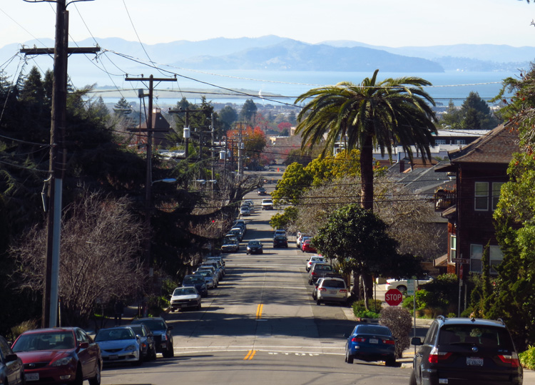
January.  The word sounds cold, evoking as it does images of textureless gray skies, barren snowy landscapes and people dressed like South Park characters.  Although I largely escape winter by living on the Pacific margin of the U.S., here in the East Bay temperatures still dip into the suboptimal 30s this time of year.  And with few exceptions, January signals the nadir of the racing season.

View from Mt Constitution Road

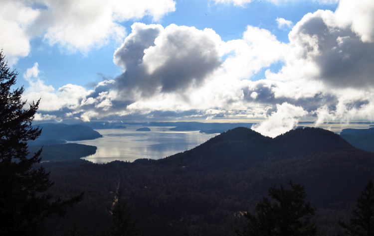
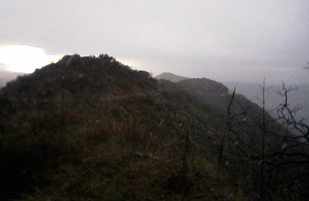
Friday’s view from Orcas Island, with blue sky and gray clouds battling for dominance

So for my first January race ever, you might think I’d choose a warm-weather outing in one of the more cold-resistant pockets of the country.  Maybe, say, the Disney World Marathon in balmy Florida.  Or the Rock ‘n’ Roll Half in hot ‘n’ dry Arizona.  Or maybe even stuff my swimsuit, running shoes and Garmin into a small duffel and head out across the ocean for the tropical Maui Oceanfront Marathon.  All logical, common sense choices.

Unfortunately, common sense didn’t cast the deciding vote this time… Julie did.

We’re told to keep our friends close and our enemies closer.  To that sound advice I’d add one more inner circle for people like Julie.  She’s been one of my closest friends since we met in graduate school.  She knew me back when my diet favored the “carbonated” and “partially hydrogenated” food groups.  We attended each other’s weddings, and she even picked me up from the airport one New Year’s Eve (!) when I could barely stay upright with the flu.  The world would be a shinier, happier place if everyone had a Julie in their lives.  And I’m not just saying that because she might stumble on this post one day while Googling herself.

Julie now lives with her husband David and two children in Redmond WA, best known to the rest of the world as the home of Microsoft.  Surprisingly, we’d never run a race together, though not for lack of trying on her part:

  • She threatened to bully me into running the Eugene Marathon with her in May 2010.  She didn’t, so I didn’t.
  • She floated the idea of organizing a team for the Ragnar Relay Northwest Passage, an idea I supported but which due to miscommunication died a quiet, neglected death.
  • She invited me to run the Victoria Marathon last year… on the same day I’d be running Chicago.
  • I suggested the Seattle Rock ‘n’ Roll Marathon in June, but was told “The Seattle Marathon isn’t all that interesting.”
  • At one point she even offered, “I’m sure I can organize a small race in the middle of nowhere for a cause no one will want to support.” That may have been her most enticing offer yet.

Finally, this past August she appealed to my trail-running sensibilities and sold me on the Orcas Island 25K, a mid-winter event staged by the folks at Rainshadow Running, a Pacific Northwest-based trail racing outfit.  Several members of her local running contingent would also be running Orcas Island, and when I sent her my registration confirmation she was pumped.  Psyched.  Excited.  Like a mosquito in a nudist colony.

And so it was that Saturday found me within snuggling distance of the Canadian border.  Roughly 30 miles northeast of Victoria, British Columbia and 40 miles south of Vancouver as the crow flies, Orcas Island is the largest of the San Juan Islands located in the northwestern corner of Washington state.  The race itself would begin and end at Camp Moran in Moran State Park and feature a climb to the summit of Mount Constitution, the highest point on the island at 2,409ft.

Katie and I flew to dreary-but-dry Seattle on THURSDAY, where after landing I kept a tight grip on my MacBook just in case the airport security/Microsoft gestapo got any ideas.

Clearly we’d landed in Seattle… where else do you see one of these?

FRIDAY morning we packed our gear into Julie’s SUV and, joined by her running buddies Charlotte and Kathie, drove the 80 miles to Anacortes before hopping a ferry to Orcas Island.  En route we saw seals, great blue heron, and plenty of seagulls.  We saw no orcas.  I was ready to sue someone for false advertising.

Four hours after leaving Redmond we docked at sunny Orcas Island, where the mercurial winter sky dangled the possibility of dry race conditions.  We’d seen the forecast and knew better.  After a brief reconnaissance drive up Mount Constitution, we checked in at the Doe Bay Resort on the eastern edge of the island.  Doe Bay is located within 6 miles of the race start and offers simple, no-frills cabin lodging that I’d recommend to anyone visiting the island.  Though somehow the five of us couldn’t find time for the clothing-optional soaking tubs at the resort.  Maybe next time…

That’s no killer whale… oh, wait, we must be in Doe Bay

After killing two hours in the sleepy bayside town of Eastsound, we made our way to Camp Moran for the optional check-in and bib pickup.  Here we also experienced Rainshadow Running’s clever, quirky alternative to the traditional race t-shirt: in the interest of conserving and reusing resources, the RR crew scour thrift stores for diverse articles of clothing, onto which they have printed the Orcas Island race logo.  Fortunately runners were also given the option to save $15 by declining a race “t-shirt” during online registration, an option I enthusiastically endorsed.

Scanning the assembled crowd of jovial runners in their fleece hoodies, puffy down jackets and wool beanie caps, the scene to my mind embodied the Pacific Northwest… if someone had cranked up “Smells Like Teen Spirit” I would’ve guessed Nirvana concert, circa 1992.  The low body mass index of the room added to the peculiar irony of this race’s former name, the “Orcas Island Fat Ass 25K.”  And speaking of low BMI… I had the opportunity during bib pickup to meet elite trail runner Candice Burt, whom I recognized from a recent Trail Runner email as having set the women’s fastest known time (FKT) during an unsupported run on the 93-mile Wonderland trail around Mount Rainier.  She was incredibly gracious and seemed happy to talk to anyone and everyone who approached her.

2013 Orcas Island 25K race shirt

Nothing says “Pacific Northwest runner” like plaid flannel race swag

That evening, while carbo-loading in our Doe Bay cabin, our group voiced two main concerns about the day ahead:

1)  The course. The previous week, race director James had inexplicably re-routed the already challenging course to add another 1,000ft of elevation gain, bringing the total elevation gain/loss to 4,450ft.  Kathie had been the first to notice James’ announcement posted on the race website: “It seems like every year I’m making some kind of change to the race course… This year’s route is totally different than any of the previous 25k courses and is HARDER THAN EVER!”  Julie, Charlotte and Kathie expressed unease over this arbitrary change; I chose to drown my apprehension in a third plate of spaghetti.

2)  The weather. Two days before the race, the forecast called for rain at lower elevations, with temperatures ranging from 38-45°F and winds at 11-13 mph; and for snowfall at higher elevations (above 2,000ft), with temps in the mid-30s, winds around 11 mph and new snow accumulation of 1-2 inches.  This would be the second time in less than a month I’d be running trails in rain and snow, although admittedly this time I’d be better prepared.  And as Washington residents, the other three members of our party were well-accustomed to running in nasty conditions (plus, Charlotte hails from Sweden and Kathie from Canada).  Still, none of this seemed to ease our collective mind, until finally we each sought refuge in the time-tested panacea for all pre-race ills: sleep.

That's the Powerline Climb beginning at mile 6

That’s the Powerline Climb starting at mile 6

SATURDAY morning was a lesson in the predictive power of meteorology, as we awoke to light rain, gusty winds and temps in the low 40s.  At least we’d had the chance to set our expectations accordingly.  We arrived at Camp Moran at 8:00am (for a 9:00am start) and, despite very limited parking, were able to park next door to the main cabin.

As already-soggy runners continued to fill the room and nervous energy mounted, James stepped to the front for his pre-race announcements.  Like everything else about his race, James himself was low-key.  He reminded us (in case we’d forgotten?) about the dreaded “Powerline Climb” he’d added to this year’s course, assuring us it would make the course more “fun” and more scenic.  When asked about cut-off times he replied that he didn’t actually know, then thought for a moment and suggested we “just be back here by 3:30.”  Finally, with a cold steady rain now falling, he led us from the comfortably warm cabin outside to start the eighth annual Orcas Island 25K.

From there things moved quickly.  Scrambling up the steep embankment to the start, I bid the others good luck and positioned myself among the front 20% of the pack.  As James’ countdown reached zero, the line of eager runners shot forward and down the paved road for ~1/4 mile before turning onto the Cascade Lake Trail, where the real race began.

My plan was to treat the day as a training run, rather than an all-out race.  Stay strong on the ascents and aggressive on the descents, but don’t do anything reckless.  My strategy was based on the tricky conditions as well as the unusual distance: I’d run only one other 25K, so it’s not as though a 25K PR would be a life-changing accomplishment.

Mike Sohaskey and fellow runners, minutes before 2013 Orcas Island 25K start

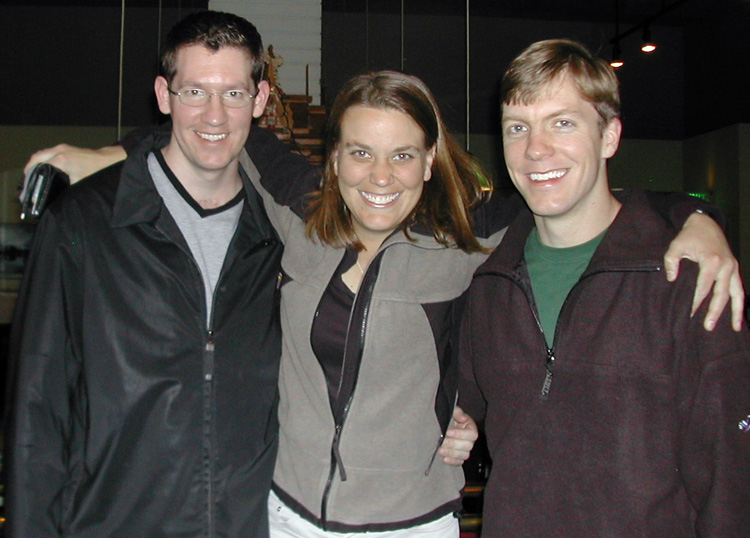
Me, Julie, Charlotte and Kathie flash our “warm and dry” smiles one last time

Because we’d all gathered indoors until the last minute, I’d neglected to give my Garmin the extra time it needed to find the GPS satellites and figure out where it was.  Apparently the impenetrable cloud canopy confused its California sensibilities, because it kept searching for satellites and asking me “Are you indoors now?” as raindrops bounced off its display.  Not the brightest gadget, so after about half a mile I gave up and – for the first time since I’d unwrapped it on Christmas Day 2008 – resigned myself to racing without my Garmin.  So this is how our forefathers did it.

Aside from short stretches on paved roads, the first 5.6 miles were exactly what I had envisioned for a trail run in the Pacific Northwest: muddy, leaf-strewn singletrack snaking through rainforest-like surroundings, past now-torrential Cascade Falls, around pristine Cascade Lake, as well as over and under moss-covered branches.  One key difference between road and trail races is the mental fatigue caused by running on rugged, uneven terrain: I couldn’t let my guard down even momentarily for fear I’d slip on a patch of mud, twist my ankle on a slippery rock or trip over a partially exposed tree root.  This constant vigilance in harsh conditions would take its toll by race end, and in the aftermath I’d encounter several runners with sprained ankles and scraped-up knees.  Such are the casualties of trail racing.

I first saw Katie with camera poised at Cascade Falls (near mile 3), then again at the Camp Moran North Arch (mile 5.6), just after the first of two aid stations.  I tossed her my gloves and turned my attention to the first major challenge of the day, the much-anticipated Powerline Trail.

Rather than having us run the more gradual switchback route, James routed this year’s course straight up the Powerline Trail, which is primarily used during dry months by mountain bikers coming down the trail.  After the race I asked Julie, Charlotte and Kathie to describe the Powerline Trail in one word; several dazed seconds later, each just shook her head as if trying to clear it of the horror.

Cascade Falls

Cascade Falls

“Abomination” was the word that came to mind as I struggled to ascend the steep, muddy slope.  The slick mud immediately reclaimed any forward progress I made until eventually, by pulling myself up on exposed tree roots and stepping in the recessed footprints of other runners, I was able to ascend the first and steepest pitch of the trail.  From there the trail turned just grassy enough to enable forward progress, but only by walking sideways uphill.  That was a racing first for me.  As I doggedly passed several runners-turned-hikers, one woman remarked, “This is an Achilles injury waiting to happen.”  By focusing five feet ahead of me, I was able to maintain a slow jogging pace up most of the Powerline Trail, while my quads and lower back protested the strain of laboring up a muddy hill at a 45° angle.

As both the Powerline Trail and the ache in my quads began to level off (mile 7.3, I heard someone announce), I realized the steady rain had transitioned to steady snow.  The next 6+ miles would be my first time racing in a winter wonderland, with much of the trail at least partially covered in snow.  Fortunately icy patches on the trail were minimal; however, footing was slowed by the accumulated snow, which made momentum and rhythm elusive prey.

Our second major climb of the day began at ~mile 9.6 and ascended a switchback route to the summit of Mount Constitution.  After jogging the first couple of switchbacks and speed-hiking the next, I fell into a jog behind two strong uphillers whose steady pace carried me to the summit.  Here the snow accumulation topped a foot, though I was generating enough body heat that cold wasn’t an issue.  Relieved as I was to have reached the zenith of the course, I was disappointed to find that road closures had prevented Katie from accessing the summit.  And the snow-spitting sky ensured there would be no panoramic vistas today.  No Mount Baker to the east, no Mount Rainier or Mount St. Helens to the south.

Following the trail of pink ribbons and the footprints of previous runners through the packed snow, I passed the second/final aid station at mile 12, where I thanked the shivering volunteers without breaking stride.  Based on my memory of the course elevation profile, I was hoping the final 3.5 miles would amount to a super-squishy downhill victory lap.

Mike Sohaskey heading up Powerline Trail in 2013 Orcas Island 25K

At mile 5.6, the Moran State Park Arch (left) doubles as the gateway to the Powerline Trail (right)

The highlight of the course, and hands-down one of the (literally) coolest things I’ve ever seen while racing, was snowed-over Summit Lake between miles 12 and 13.  If I’d had my camera – or even my camera phone – I would have stopped to snap a few pictures of the tranquil, picturesque landscape.  I’m surprised I didn’t launch myself headlong over a tree root while admiring the expanse of frozen white.

For a 250-person race, I spent a surprising amount of time running by myself.  Much of miles 2-6 (up to the start of the Powerline Trail), miles 7.5-9.5 (between major ascents) and mile 12 to the finish were spent in solitude, and I was able to enjoy the natural beauty of Orcas Island without having to worry about passing or being passed on sodden singletrack.

By the time the snow and ice transitioned back to rain and mud, I was eager to stretch my legs and make up for lost time.  Emboldened by more reliable footing with fewer large rocks and tree roots, my stride became more fluid, and I barely blinked as overhanging fern fronds swatted me wetly in the face.  Despite my faster pace, I was shocked that only a single runner passed me on the ~4-mile descent to the finish.  I expected that a caravan of reckless, eager-to-finish runners would overtake me, but then again that’s what prolonged steep ascents will do to you… the will may be there at the end, but the stamina is gone.

With neither my Garmin nor a single mile marker to gauge distance, the last four miles were peaceful yet seemingly endless.  Refusing to let my tired mind think ahead to the finish line, I arbitrarily repeated “1-1/2 miles to go” to myself while trying to maintain an aggressive pace.  With about a mile to go my victory lap was rudely interrupted by a nasty uphill jag, which although unwelcome would hopefully reinforce my lead over any unseen pursuers.

Mike Sohaskey finishing 2013 Orcas Island 25K

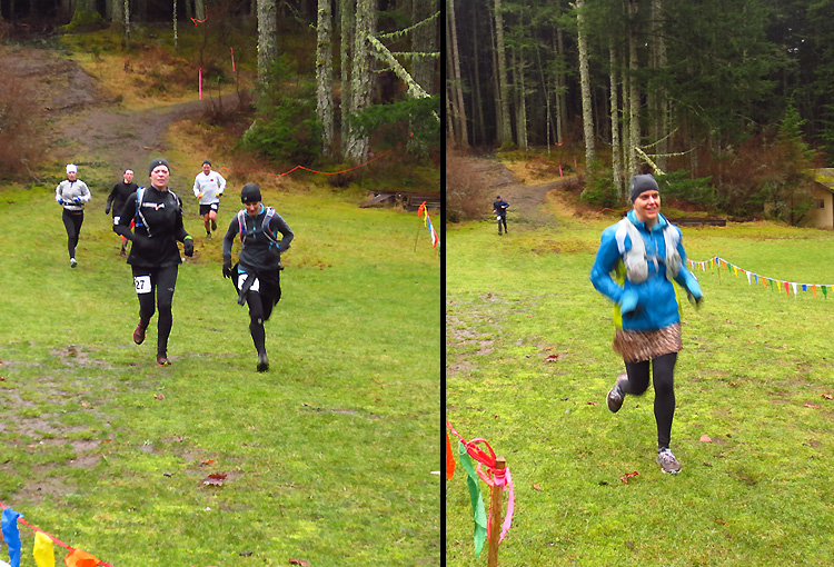
Surging toward my hard-earned high five from James (hidden from view, with umbrella)

As I re-emerged onto paved Olga Rd, black arrows on yellow signage pointed the way home past rows of parked cars.  A final uphill surge brought me to the precipice of Camp Moran, where turning left I dropped down the muddy slope, crossed the grassy field and – with Katie’s cheers penetrating my mud-brain barrier – high-fived James to finish with an official time of 3:12:06.

Mentally more than physically exhausted, I reunited with Katie (who’d wisely sought out the relatively dry comfort of the cabin porch) and stood watching the action while slowly regaining my wits.  Then I hurried inside to towel off and don dry clothes, before returning outside to await the others.  Exactly an hour later the three of them emerged as a group into Camp Moran, finishing within 30 seconds of each other and looking as dazed as I’d felt an hour earlier.

The consensus among Julie, Charlotte and Kathie was overall displeasure with James’ new-&-improved course design.  Another of Julie’s Seattle running buddies, who’d run this race last year, finished more than 38 minutes behind her 2012 time.  And I overheard another runner voice the sentiment that had crossed my own mind late in the race: “Most of the marathons I’ve run were easier than this.”  Kathie (though not Julie) agreed.  At any rate, this had been a whale of a course.

You go, girls! Charlotte, Kathie and Julie in a photo(genic) finish

On the other hand I did run a 25K PR on Orcas Island… though in the interest of full disclosure, I’d gotten lost (along with the leader at the time) during my only other 25K and ended up extending that race by 3 or so miles.

The winner finished with a mind-blowing time of 2:17:12; I’d love to watch the video of his ascent up the Powerline Trail.  And Andrew Fast did his surname proud with a second-place finish in 2:22:59.

In the main cabin I stabilized my blood glucose levels at the post-race spread while waiting for the others to shed their wet gear in favor of dry clothes.  Then, with the double whammy of stifling heat and dank musty runner threatening to overpower us, we made our exit.

We compared race notes over a life-affirming lunch at Tee-Jays, a hole-in-the-wall Mexican eatery in chilly, seagull-rich Eastsound.  Apparently Charlotte had tripped at one point and managed to twist in midair to avoid landing on her previously broken (and still-healing) wrist and elbow; she’d escaped with a bloodied knee and bruised hip.  Julie recalled another runner whom she alleged had been “endorphin goggling,” based on supposedly flattering comments he’d made while running behind the three of them (I’m guessing her cheetah skort inspired him).

Eastsound

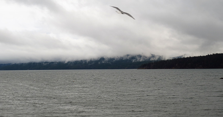
Eastsound was swathed in fifty decidedly unerotic shades of grey

We killed a leisurely afternoon in Eastsound before making our way to the docks in time to catch the evening ferry back to Anacortes.  From there, as a collective exhaustion settled over the car, Julie navigated the 80-mile return trip to Redmond through darkness and driving rain.  In Redmond we said our goodbyes and cheerfully parted ways with Kathie and Charlotte, who had been terrific travel companions.  That night I barely remember my head hitting the pillow on the pull-out sofa bed in Julie and David’s guest room.  Even the sound of her son, from his room next door, urgently calling for his mom in the wee hours of the morning barely registered through the haze of my Powerline-induced stupor.

In retrospect, Orcas Island was one of the most memorable and surreal races I’ve run.  In just two days we covered a lot of ground – by car, by ferry and by foot – in a variety of weather conditions – first sun, then rain, then snow.  Thanks to Julie’s persistence in luring us to Washington and her hospitality once we arrived, I spent quality time with her family, met new and interesting people, immersed myself in the Pacific Northwest trail running culture… and returned to the Bay Area with a rattling cough that has slowly succumbed to sunshine and 60° temperatures.

Hey, that’s what friends are for.

*******

PRODUCTION: Unlike my travel companions, I appreciated the difficulty of the new course.  I figure if I’m flying to Seattle, driving 80 miles north, hopping a ferry to Orcas Island and then driving another 15 miles to the race site, I want a legitimate challenge and not a flat out-and-back on paved streets.  What I don’t want is Rock ‘n’ Roll Orcas Island.

James and his crew did a nice job of marking the course… wherever the possibility existed for a wrong turn, pink ribbons and arrow signs pointed the way.  But although I stayed on course throughout, there were lengthy stretches of solitary running where a “reassurance ribbon” would have eased my mind.  Just a thought for next year’s race.

Race registration itself cost only $45, plus a $3.25 processing fee; however, this price of admission didn’t include the ferry ($85 for our five-person vehicle), the Washington State Discovery Pass required to enter Moran State Park ($10 for one day or $30 for an annual pass), or lodging.  So depending on how many people travel together and where they stay, Orcas Island could end up being a less-than-frugal outing.

The race volunteers can never be thanked enough; they were tremendously helpful, friendly and wet.  And the post-race spread was to my liking: plenty of fruit (bananas, oranges and pineapple) and sugary drinks, plus local microbrews, soup and a well-stocked sandwich counter.

The Pine Hearts provide post-race entertainment after 2013 Orcas Island 25K

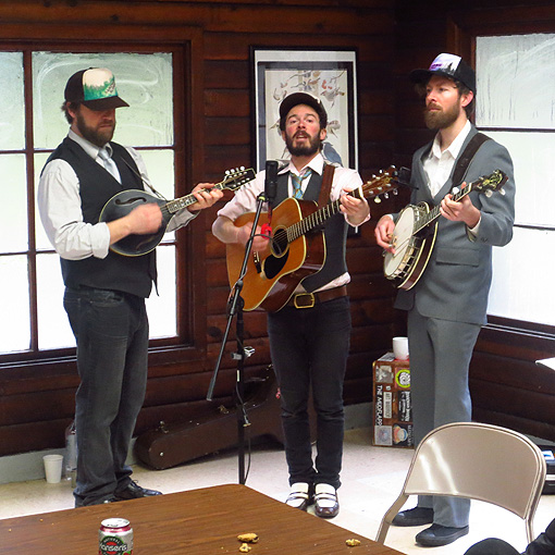
The Pine Hearts provided post-race music… Katie guessed “Indigo Girls” on every song

As for race swag: unless INKnBURN is involved I’m not a huge t-shirt guy, so I appreciated the “reuse and recycle” ethic practiced by James and his crew.  My biggest disappointment wasn’t the lack of a conventional race t-shirt, nor the quad-busting course, nor even my failure despite my best efforts to give myself pneumonia.  No, ’twas the lack of finisher’s bling that most conspicuously cast its cruel shadow across this otherwise radiant heart.

The medal doesn’t have to be fancy – it can be something old, new, borrowed or blue.  It just has to be SOMETHING.  A reminder of Orcas Island that years from now still triggers instant memories of the Powerline Trail and Summit Lake.  I know that “real” trail runners – those who claim to run out of a sheer love of nature and their fellow man – typically reject the notion of medals (and other material possessions).  And granted, if there were no medals I’d still run, and run hard.  But at the same time, seeing the number of runners last weekend happily sporting “Orcas Island 25K” argyle pullovers or Hawaiian aloha shirts, I’d be surprised if most of them weren’t also medal-grubbing types like me.

If and when I make it back to the Pacific Northwest, I’d definitely race with James and his Rainshadow Running crew again.  Especially if next time they have medals.

GEAR: Faced with slick mud, slippery rocks, ankle-deep snow and patchy ice, my Merrell Mix Master 2s again outperformed the rest of me.  Orcas Island was their toughest test to date, yet the shoes remained grip-tastic and provided reliable footing over the entire 25+K.  Now if only Merrell would make a trail shoe that lifted itself over rocks and tree roots when its owner got tired…

BOTTOM LINE: If you’re new to trail running and looking for a first-timer’s race to ease yourself into the sport, keep looking because this one’s not for you.  But if you’re a trail racing aficionado seeking a low-key yet challenging race in a picturesque setting, I’d recommend Orcas Island in an (elevated) heartbeat.  And admittedly I’m now intrigued by the 50K, which will be held this Saturday and which includes 8,400ft of elevation change.

CHECK OUT CHARLOTTE’S RACE REPORT FOR ANOTHER (MORE CONCISE) PERSPECTIVE.

FINAL STATS: (thanks to Charlotte for distance and elevation change data)
January 26, 2013
16.34 miles (26.3 km) on Orcas Island in Olga, WA
Finish time & pace: 3:12:06 (first time running Orcas Island), 11:45/mile
Finish place: 32/241 overall
Race weather: windy, rainy, snowy and cold (temps ranging from low 30s to low 40s)
Elevation change (Garmin Connect software): 4,505ft total gain/loss

You never stay the same. You either get better or you get worse.
– Jon Gruden, football coach-turned-ESPN analyst

View to the Bay

One thing that does stay the same: the view from our street to the Bay, and Angel Island beyond

“One day won’t matter.”

Like most runners (plot spoiler!) I love to run.  And that in itself is almost always enough to motivate me off my combination La-Z-Boy recliner/hyperbaric chamber and out the door.  Almost.  But as anyone who’s ever laced ’em up in the name of self-improvement can tell you, some days the will is just… not… there. Some days, for whatever reason – be it physical or psychological lethargy, uncooperative weather, or body parts feeling just a bit “off” – working up the motivation to run can feel like more trouble than its worth.  Some days we’re reminded that an object at rest stays at rest, unless acted upon by an imbalanced force.

And on those days when I don’t feel tough and I don’t feel like going, the sentiment at the top of this post flashes to mind.  Having grown up in a semi-redneck southern culture that revolved around Friday nights and venerated its high-school football heroes, I learned to shrug off coach-speak from an early age.  Case in point: my high-school basketball coach’s favorite expression was “Excuses are like a**holes, everyone has one and they all stink.”  He was pretty proud of that one, as confirmed by the smirk that invariably followed.  So I don’t expect coaches to enlighten me on the far-reaching implications of the Higgs boson or the defining principles of Jeffersonian Democracy.

But Jon Gruden has a point… one day does matter, because for better or worse you won’t come out of it the same way you went in.  Just ask Marty McFly.  So then it’s my choice what happens between the two turnstiles.  Realistically, one isolated day is just that – in the grand scheme of the fitness cosmos, how much difference can one day really make?  Instead, I worry that one day of deferment matters for its potential to plant a psychological seed that will grow aggressively, feed on laziness and eventually blossom into a full-grown weed that overgrows my meticulously cultivated training garden.  What I fear is the downward spiral… though not the 1994 Nine Inch Nails album, that was a keeper.

Cut to last week – Wednesday, specifically – and I found myself confronted with one of those days.  The weather had been as wintry as it gets here in the Bay Area: drab, brushed-aluminum skies,  temperatures in the high 40s and a persistent “will it or won’t it?” threat of rain that I was convinced would only play its hand once I stepped outside in t-shirt and shorts.  My East Bay neighbors, looking like penguin hunters, were bundled up to their eyeballs in North Face down jackets, scarves and woolen caps.

And the day was playing havoc with my motivation.  In general life seems to move more slowly in January, as people gradually shake off their post-holiday doldrums and strive to get their groove back.  For me, the same goes for running… January’s always been a blank month on my racing calendar, the one month of the year in which I immerse myself in my training and focus on ramping up my intensity for the upcoming racing season.  So with that kind of diligence, what would one day matter?

(© 1995 Roz Chast, published in The New Yorker)

(© 1995 Roz Chast, published in The New Yorker)

True, I had no legitimate reason to blow off my workout, as so much of the country has this time of year… no snow, no ice, no real excuse to let inertia carry the day.  The spark just wasn’t there.  Mix one part general malaise with one part other-things-to-do, sprinkle in a dash of (contrived) under-the-weatherness, and there you have the recipe for my mid-week lethargy.  I even tried to convince myself that a) I’d have a less-than-productive workout if I did run; and b) the rest/recovery would do me good and enable a stronger run the next day.

And my body wanted to believe the voices in my head, it really did, if for no other reason than this: Wednesday = track work.  After all is said and done, speedwork on the track is my favorite workout of the week, and aside from tempo runs the only workout I clock consistently.  No other feeling within the training cycle rivals the adrenalizing combination of fatigue, soreness and accomplishment that drapes itself around me as I step off that 400m oval.  But that’s after all is said and done.  And both brain and body know full well that by the time it’s over, we’ll all be done.  Because running fast hurts.  And honestly, my body isn’t very good at it… out on the track I don’t feel like a highly evolved machine, and I sure don’t feel born to run.

But when I come out of that final turn and down the home stretch on my final lap, with my brain firing off well-intentioned orders to the gummy worms below my waist where my legs used to be, with my stride deteriorating rapidly, with my eyes now narrow slits to conserve the energy required to keep them open, with my physiological train in danger of coming off the tracks, and with that imaginary finisher’s tape oh so close… when I stumble across the finish line and I’m immediately awash in a whole-body response I’d characterize as more “drained” than “pained”… when that finally happens, now THAT will be awesome.  It always is.

So rather than listen to the voices in my head last Wednesday, I followed my usual path of most resistance.  And 30 minutes later I found myself chasing the endorphin dragon around the dirt track behind Martin Luther King Jr. middle school in North Berkeley.  Genetics might also have compelled me here: after all, my brother had once fought off his own litany of excuses for 4,012 consecutive days, running at least two miles per day during that time.  That’s less than a week short of 11 years.  Ironically, his streak (plus a rib or two) was only broken when the van in which he was driving was t-boned at an intersection during a 100-mile relay race.

Point is, maybe a valuable thread of masochism/self-discipline runs (pun unavoidable) in our family.  Barring aggravated soreness or an injury that threatens to derail my training, I can’t in good conscience skip a workout.  I run my speedwork alone, so nobody else would know or care.  But then, nobody else matters.

A great place for speedwork:

No better place for speedwork: 4 running tracks within 2 miles of our house
(MLK Jr. is circled in green, UC Berkeley in teal)

I’d decided my temperament this day was more suited to the low-key, off-road ambience of the MLK Jr. dirt track, rather than the all-weather synthetic surface at UC-Berkeley.  The pristine UC track is generally preferable for speed workouts, though not so much during the winter, when runners and boot-campers hurry to squeeze in their workouts between the time the track and field team finishes practicing and the time the track closes at dusk.

Wednesday’s plan called for a 2-mile warmup jog, followed by the speed portion of the program: a fast 4×1 mile (one mile, or four laps, repeated four times) with 400m (one lap) recovery between each mile.  I’d finish up with eight striders to work on my running form, and finally a 2-mile cooldown jog.  At first blush four miles doesn’t sound like much, especially with a slow lap to recover between each mile.  But if you truly run each mile (rather than mosey, jog or trot at the oft-recommended 10K pace), you won’t feel cheated by the time you’re done.  And each recovery lap will feel like you’ve earned yourself a bonus life, the running equivalent of the 10,000-point mark in Pac-Man.

After an uneventful 2-mile jog to the track and one warmup lap, I accelerated across the start line (marked by a small puddle in lane 1) as the {beep} of my watch timer signaled the toughest part of this workout – mile 1.  For me the first mile of these sessions is always the slowest and most laborious, as the body adapts to the sudden shock of being forced out of its comfort zone and into an immediately stressful situation.  The body at once becomes needy: the heart needs to pump more blood faster, the lungs need to take in more air and exchange more carbon dioxide for oxygen, the muscles need to ramp up their number of contractions, the neurons carrying signals throughout the body need to to fire more frequently, the bones need to manage the increased biomechanical stress.  These are a few of the dramatic challenges that must be overcome quickly for the body as an integrated whole to have any hope of completing one mile, let alone four or more.

But having experienced “starter shock” as a regular feature of my training, I quickly realized that something was different about today’s opening mile.  Something altogether unexpected, though not unwelcome.  I felt fast (for me).  Really fast (for me).  In fact, faster than I could recall feeling for an entire mile on any track, much less a bumpy dirt one.  And as I crossed that puddle for the fourth time, the timer on my watch stoically reported the good news – 6:27.  Whoa!  My momentary swell of accomplishment was tempered by the understanding that I should probably dial back a bit, lest I blow out my tires after only two miles.

But after my first recovery lap, as I fell into a smooth rhythm on mile 2 and glided (ok, that may be overstating things) around each turn, I knew I had a legitimate shot to improve on my first mile.  Zagging around two slow-moving conversationalists in the inside lanes, I rounded the final turn, surged past my favorite puddle and glanced at my watch – 6:22!  I’ve never timed myself to know just how fast I can run a single mile, but 6:22 was no doubt the fastest mile I’d ever timed in the course of training.  And when I followed that up with a 6:23 on mile 3 and another all-out 6:22 on mile 4, my brain registered that hey, maybe all this speed training does do more than just hurt!

Just to confirm that MLK Jr. is a regulation track, I mapped it on favoriterun.com

Just to confirm that MLK Jr. is a regulation track, I mapped it on favoriterun.com

Everything had just clicked, and on this of all days.  Maybe chaos theorists are on to something.  As all systems returned to equilibrium, I finished up with 8 striders and then left the track on my 2-mile cooldown jog, thankful as hell I hadn’t heeded the voices and blown off the day.  As it turns out, those 25 minutes and 34 seconds spent redlining on the track set a strong tone for the rest of the week, as Friday yielded its own fast tempo run and Sunday a well-paced 19-miler over a hilly yet scenic course.

Who knows, maybe I never top my mile times from Wednesday’s track workout.  But it won’t be for lack of trying.  I can easily imagine 1,000 different scenarios that might have played out had I opted to stay inside that afternoon – some heroic, others less than fulfilling.  All I know with certainty is that I wouldn’t have run my best timed mile ever, if I hadn’t bothered to run at all.  Or as hockey hall-of-famer Wayne Gretzky so memorably put it, “You miss 100% of the shots you don’t take.”

So I’ll keep firing shots on goal, every chance I get.  Sure, there’ll be those that sail wide or ricochet off the crossbar, but there will also be plenty that find the back of the net.  Because every shot matters, and I want to need to get better.  And contrary to how this post may read, I’m not writing some sort of misguided advice column here, to offer training advice to people who in many cases are better runners than I am.  I’m pretty sure a PhD in Cancer Biology and one sub-3:30 marathon qualifies me to stay in my blogging lane, not play running coach.  Nor would I want to.  In fact, I’d encourage every runner to do their part to increase my likelihood of improving on last year’s racing percentile in 2013: kick back! blog more! run less.

Just don’t listen to me.  I don’t even listen to myself.

Mother Nature doesn’t care if you’re having fun.
– Larry Niven

This wasn’t part of the plan.

Actually, the steady uphill jog on nice wide dirt trail was the plan, the reason I was here.  But freezing temperatures? Near-blizzard conditions?  And a disturbingly cold headwind that was – almost scornfully – treating my rain-soaked body like high-school football players treat one of those paper banners that cheerleaders hold up at the beginning of games? Using the ten fingersicles on the ends of my arms as blunt-force instruments, I brutishly hammered out a text to let Katie and Chuck know I was halving my intended 8-mile ascent and turning around.  This was turning out to be a typical winter run in our Midwestern United States.

Except this wasn’t the Midwest… this was Southern California.  Orange County, to be exact.  Average yearly snowfall of zero inches.  And that’s rounding up.

Maybe this would be my comeuppance for shrugging off both the Mayans and Weather.com


Maybe this day would be my comeuppance for shrugging off both the Mayans and Weather.com

So I could hardly be blamed for finding myself in a driving snowstorm, wearing my usual comfortable winter running gear of t-shirt and shorts.  And the finishing touch – the coup de grâce in this absurd comedy of errors – was the bottle of cold coconut water that now threatened to drain all remaining feeling from the fingers wrapped tightly around it.

It was only natural to ask how this had happened.  Much as I wanted to, I couldn’t really blame my brother for this one.  True, it was Chuck who had – after careful consideration – recommended I run the Harding Truck Trail to Modjeska Peak during our New Year’s visit to SoCal.  And the elevation profile from his Garmin had sealed the deal, showing a daunting route that began at ~1,400ft and summited 12 miles later at ~5,400ft, making Modjeska second only to its next-door neighbor Santiago as the highest peak in Orange County.  How could I refuse an offer like that, with an ascent unavailable in the Bay Area?  And so, begrudgingly, I let Chuck off the hook.

Certainly The Weather Channel had steered me wrong.  Moments before we’d hit the road for Modjeska, I’d checked Weather.com and found a forecast of low 50s and a 10% chance of precipitation for the area around Modjeska Canyon.  And even if I were to get wet out on the trail, no worries… I’d just managed eight miles in a steady SoCal downpour 24 hours earlier, and in the process gained a front-row seat to a magnificent full (and near-double) rainbow stretching from Laguna Niguel to Dana Point.  I could almost hear the leprechauns on each end frolicking in their piles of gold coins.  Plus, I’d maintained a respectable pace on slick sidewalks.  So more rain wasn’t a concern, despite the mud it would generate.

But driving snow?  No, this definitely wasn’t part of the plan.

The splice is twice as nice: even my low-res cell phone camera couldn't spoil this iridescent display

The splice is twice as nice: even my low-res cell phone camera couldn’t spoil this iridescent display

I’m not the superstitious type, but maybe simple karma was to blame here.  After Amy recently wrote about her winter training in Albuquerque, I’d joked that as a Californian I enjoyed “hearing other people’s stories of training in cold weather, without being able to relate in any way.”  So maybe I’d brought this on myself – a (literally) cold (literally) hard lesson in winter-weather empathy.

But let me rewind a bit: last Sunday seemed like any other characteristically mild winter day in SoCal, as Katie and I made the 20-mile drive out to Modjeska Canyon.  Approaching our destination, I realized I’d forgotten my water bottle, so we made a brief pitstop to buy cold coconut water.  A surprisingly sharp chill greeted us as we stepped out of the car, intensified by a monochromatic gray sky that overpowered the usual Orange County sunshine.  Meanwhile, our car’s “outdoor temp” display read a balmy 55°.  Ideal winter running weather.

We met Chuck and Laura at the Tucker Wildlife Sanctuary, at the foot of Modjeska Peak.  Conveniently (for him), Chuck was nursing an injured hamstring, so Laura and I would be running this one by ourselves.  In the men’s room hung a sign announcing the park’s recent loss of state funding, and imploring the reader to bring extra toilet paper, paper towels and hand soap with them to share on their next visit.  Ah, California… the golden beholden state.

Mike Sohaskey and Laura running in Modjeska Canyon

Off to a good start – if only the sky in front of us had stayed this gloriously drab
(photo by Chuck, without whom I’d be pulling random images off Google)

The warning chill in the air prompted me to pull on my arm sleeves – my usual ample protection against the California winter.  As Laura and I trotted toward the dirt to start our immediate ascent on the Harding Truck Trail, a gray-bearded fellow in a faded baseball cap leaned out the window of his pickup truck, smiled and declared “You’re just in time for the rain!”  Though the skies remained bleak the air remained dry, and I smiled back absentmindedly as we trotted on without a second thought.  Dirt or not, it wasn’t like me and my trusty Mix Masters couldn’t handle a bit of rain.

With no level-ground opportunity to warm up my legs and lungs, I acclimated to the ascent by jogging alongside Laura for the first few minutes.  Chuck awaited us at the ¼-mile mark with camera in hand.  Laura and I chatted and set expectations: since she hoped to run a low-key New Year’s Eve marathon the next day, her goal on this day was ten miles (five up, five down).  Despite our late start, I was aiming to cover 16 miles (eight up, eight down) and experience as much of the trail as possible on my first outing.  So Laura would most likely be done and gone by the time I found my way back to where Katie awaited at the wildlife sanctuary.

At the ¾-mile mark I picked up my pace and pulled ahead of Laura – I’m more of an uphiller, she’s more of a down-hiller, as I’d be reminded later.  I was eager to tackle the trail and find out how it stacked up against my favorite Bay Area hills.  Ironic that my main concern at the start of this run – the persistent ascent – would quickly become my least.

Mike Sohaskey running Harding Truck Trail

Trail Running for Dummies: Don’t keep going when the sky ahead of you looks like this
(photo by Chuck, who no doubt made a beeline for his car right after this was taken)

At the one-mile mark the course’s uphill trajectory gives way to a brief ¼-mile downhill jag.  Here I further increased my pace and fell into a comfortable rhythm.  Bounding along I had the trail more or less to myself, and I planned to savor my light-footed feeling before the coming uphill grind took its toll.  The previous day’s showers had softened the dirt just enough to provide optimal footing – not too dusty, not too muddy, with just the right combination of firmness and tack.

Glancing up and ahead of me, I noticed for the first time that the light-gray clouds had yielded to a dark, ominous haze that now engulfed Saddleback Mountain – comprising Modjeska and Santiago Peaks – and which threatened to swallow all remaining light.  Suddenly my surroundings looked like a Photoshop creation, as though someone had applied a “Middle-earth” filter to the scene: had I left Orange County and entered the Misty Mountains?

My first sense that a light mist had begun to fall was the tiny droplets that splashed against my sunglasses and merged into a watery film (yes, sunglasses, I was naïvely confident that the sun would eventually break through the clouds… hey, this was Orange County!).  As the trail wound its way upward, I periodically rounded a corner and found myself running into a brisk headwind.  Wind is hands- (and heads-) down my least favorite part of running, but fortunately this was relatively mild and only minimally impeded my progress.

Not as impressive as Chuck's

Not as impressive as Chuck’s 24-mile elevation profile, but I’ll be back to finish the job

As my Garmin chimed to signal the end of mile two, the mist gradually transitioned into legitimate rain, and now each turn seemed to greet me with a colder and more powerful gust than the one before.  The wind began to change direction erratically, blowing the rain diagonally as though searching for the most efficient way to ensure my discomfort.  Wind and rain continued to build in intensity as my Garmin signaled the end of mile three.  And moments later, things got (d)icy…

Maybe it was my focus on pushing forward up the trail.  More likely it was the incongruity of snow in Southern California (and below 3,000ft at that).  In any case I failed to register the first few snowflakes drifting around me, until at last my eyes synced with my brain, jarring me back to reality.  Sure I’d realized the temperature had been dropping steadily as I’d ascended out of Modjeska Canyon… but shortly before mile three I would’ve pegged it at mid- to high 40s, maybe low 40s with wind chill.  Now, watching the first airborne snow I’d ever seen in Southern California, it was clear Mother Nature had upped the ante.

Always the optimistic/stubborn runner, I persuaded my brain that: 1) snow was preferable to rain for its consistency; 2) having run only three miles, I couldn’t turn back now; and 3) this was my golden opportunity for a winter wonderland run in the snow, having been denied in Dallas six days earlier when a vigorous Christmas snowfall had followed a freezing rainstorm that coated sidewalks and streets with a thin layer of ice.  As I embraced my questionable decision-making and pressed onward toward Modjeska Peak, I did make one allowance for the weather and my soggy state, electing to truncate my run to 12 miles (six up, six down) rather than the intended 16.  That way I’d likely catch Laura on my way down as well.

snow on modjeska

Not bad, actually, for a photo of falling snow taken with frozen fingers on my tiny cell phone camera

But my expectations for this day took a final nosedive as I reached the 3.5-mile mark and the snowfall intensified to – I cannot tell a lie – blizzard proportions.  Like a swarm of fluffy white bees attacking my face and body, the swirling snow rode the wind currents downward from the dual peaks of Saddleback Mountain.  My primary concern quickly became the ever-increasing stiffness in my finger joints, as numbness threatened to replace all feeling at the ends of both arms.  I cursed the #@*&ing bottle of coconut water that was my faithful companion – the only thing worse than holding on it, I considered, would be dropping it.  That wasn’t going to happen, and I didn’t want to simply dump out the bottle on the trail.  So unfortunately the two of us were in this together to the bitter end.  And I was already bitter.

Somehow, despite my discomfort and the absurdity of running through a driving snowstorm in a soaked t-shirt and shorts but no gloves, I had one stupid decision left in me, and I resolved to reach mile 4 before turning around.  Blame it on mental numbness, but somehow the four-mile mark became the hard and fast limit of what I was willing to concede.  So with head down I plowed forward up the trail, swallowing snowflakes and with hands wrapped inside my t-shirt as protection against the biting wind.

I was starting to think I’d also lost feeling in my Garmin, when at last it rang out the end of both mile 4 and my uphill trek at a mere 3,113ft.  Fumbling with my phone, I awkwardly pounded out a “snowing! turning back now” text to Chuck and Katie with minimal cooperation from the semi-responsive stubs formerly known as fingers.  Then I swung a U-turn and launched myself back down the trail, gaining an immediate reprieve from the snow and wind which were now largely at my back.

Mike Sohaskey and Laura post-run

Laura and I thaw out at the Tucker Wildlife and Soggy Runner Sanctuary
(photo by a warm, dry Chuck)

Cruising downhill now, I alternated between shielding both hands in my t-shirt and beating each hand against the opposite forearm to regain feeling and keep the blood flowing, while the chilling effects of my water bottle continued to counteract my efforts.  Fortunately the descent proved smooth enough, and soon I caught up with Laura, still struggling up the trail below the snowline around mile 3.  “There you are!” she sounded relieved as she saw me squishing toward her.  Apparently she’d tried to call me after she’d run through a flurry of hail I’d somehow avoided.  Laura regularly competes in (and completes) 50-mile races, but even before reaching the snowline she was ready to turn around.  Together we covered ground quickly as I hustled to keep pace behind her dogged downhill stride.  I was surprised during our descent to have to sidestep and hurdle so many newly formed puddles and rivers; this was a much different trail than the one I’d felt so sure-footed on just an hour earlier.

Finally we reached the Tucker Wildlife Sanctuary, where we found Katie and Chuck waiting out the rain in the car.  Owing to the limited cell coverage in the canyon, neither had received my text, and both were more than a little surprised to hear we’d encountered hail and snow on trail.  Though I may have been pushing my luck when I claimed to have also seen a Bumble.

Still in my wet t-shirt and shorts (though at least I’d brought long pants to pull on over my shorts), and with my belly now full of coconut water, the four of us reconvened for a post-run snack 15 minutes later.  From the strip mall parking lot in Mission Viejo we could clearly see Modjeska and Santiago Peaks, each of which was now capped with a very fine but undeniable blanket of newborn white.  Though pleased to have my story confirmed so graphically, I was shocked to see how quickly the snow had accumulated.  The scene warmed the cockles of my – ah who am I kidding, no it didn’t… I was still shivering from the damp t-shirt and shorts that clung to me like frightened children.

Snow on the peaks

Those look like late afternoon shadows, but that’s snow on Modjeska (center) and Santiago (right)
(photo by Chuck, who then got the Snow Miser song stuck in his head)

As Saddleback Mountain receded in our rearview mirror, my phone beeped with a message from Chuck, who’d finally received my earlier text: “Snow? What idiot told you to run up a mountain?”  Unfortunately I’d been denied the long uphill run I’d planned for that day.  But I’d gladly trade a few extra miles for one of the more bizarre training runs I’ll likely ever experience, complete with rain, snow, hail, earth, wind & fire (and what a funky day it was).  All within an hour of The Happiest Place on Earth.

Based on what I saw of it, I’ve no doubt the Harding Truck Trail is tremendous running terrain on just about any other day of the year, and in fact the Harding Hustle in July has now joined my short list of potential summer races.  At which time the “fire” part of that forecast may very well come true.

In the end, the day added yet another verse to the anthem that runners (and especially trail runners) know all too well, and which author Larry Niven summarized so elegantly: Mother Nature doesn’t care if you’re having fun.  She doesn’t care if you’re too hot, or too cold, or hungry, or thirsty, or sunburned, or wind-chapped, or rain-soaked, or well nourished, or craving carbs, or fully hydrated, or chafed, or blistered, or breathless, or numb, or dressed appropriately, or chasing a PR, or lost, or trying out your brand-new trail shoes, or allergic to poison ivy, or scared of snakes, or tired of climbing hills, or roughed up after tripping headlong over a tree root, or unable to see ten feet in front of you, or physically spent, or psychologically exhausted, or a first-timer, or a seasoned veteran, or a prince, or a pauper, or out of water, or in the wrong place at the wrong time when something bigger and stronger than you gets hungry, or trapped with your arm crushed under a boulder and only a dull pocket knife between you and The End, or comfortable in any way.  She’s an equal opportunity offender, and she just doesn’t care.

Ours may be an abusive relationship, but she’s my kind of lady.

Runners have great stories, so I’m curious: what has been your most bizarre/unanticipated running experience?

2012 by the number

Posted: January 1, 2013 in CATCH-ALL, Year in Review
Tags:

Statistics are human beings with the tears wiped off. 
– Paul Brodeur

cartoon07

(© 1980 Arnie Levin, published in The New Yorker)

I love numbers.  As a scientist I genuflect at their altar, and I understand the power of their use and (maybe more so) abuse.  But I don’t so much love them in my running.  Sure, like most runners I’m constantly chasing my next PR.  But many of my training runs are unscripted, and I often leave my Garmin at home.  Admittedly I do track most of my miles, but the idea of counting my every step flies in the face of why I run in the first place.  I train, I train hard, and I try to get everything I can from everything I’ve got.  I’m not convinced more numbers will help me do that.

On the other hand, I do acknowledge and appreciate their importance for many runners, and I’ve now read several blogs that break down 2012 by the numbers: total miles run, races subdivided by distance, average finish times, average pace, even the number of GU packets consumed (ok, I might have made that last one up… but I’m betting it’s out there somewhere).  The head-spinning reams of statistics in the running blogosphere – together with lingering injuries – provide their owners with a clear, concise representation of their personal year in running.  Naturally all these blogs got me thinking about which of my own running numbers matter the most.

And I realized that, aside from personal records, the only number I really care about is this one: 91.  That’s my overall race percentile, meaning that I finished in the upper 9% of all runners at the ten races I ran in 2012.  If I were to combine my seven half marathons, two marathons and one 50K from this past year into a Pangaea-like super race, I would have crossed the finish line 5,433rd out of 61,281 finishers.  Or to turn that lemonade back into lemons, I finished in the top 9% of all losers.  That’s the number I’m most focused on surpassing in 2013… the five pairs of new running shoes I bought in 2012 notwithstanding.

I hope you hit and surpass your own numbers in 2013, running or otherwise.  I realize this blog, like running itself, is an inherently selfish act, and I appreciate your indulging my selfishness.  Except for you Mom, I know you’re only here to make sure I wear clean underwear on every run.

Happy New Year!

090914_cartoon_c_a14283_p465

With a little luck, I should easily double my shoe collection in 2013
(© Matthew Diffee, published in The New Yorker)

Do you know about the trail that links the East Bay Regional Parks?  Have you run it?  If so, what is/are the best section(s)?
– Fellow East Bay runner (and now marathoner) Jen

Continuing on with my two-day goal of mapping a 32-mile course from Wildcat Canyon to Chabot Regional

DAY TWO (TILDEN TO CHABOT):

Arrows signify the boundary where each Regional Park/Preserve begins

Arrows signify the boundary where each Regional Park/Preserve begins

Day Two of my East Bay trail hazing adventure would begin at the 12-mile mark of last week’s run, in the parking lot of the Tilden Park Steam Trains.  Katie dropped me off amid the teeming masses of frazzled parents and unruly kids, and with full energy reserves I crossed Lomas Contadas and picked up the Bay Area Ridge Trail headed toward Sibley.  The next 11 miles passed uneventfully, and roughly two hours later I found myself back in Redwood Regional on the West Ridge Trail, looking for the turnoff to the Golden Spike Trail.

There are two distinct ways to access the Golden Spike Trail.  The first is the route I took the previous weekend to finish my run: follow the West Ridge Trail downhill to its end, cut a hard right on to the Golden Spike Trail, then follow it back uphill (sound fun yet?) and continue on your way.  I prefer the alternative route, though it can be a bit tricky because there’s no sign indicating the turnoff for the Golden Spike Trail.  Here it is: just before the West Ridge Trail takes a sharp left turn and begins its final steep descent, look for a “no bicycles” sign (i.e. a bicycle with a red diagonal line through it; see below) on the right side of the trail.  This sign acts as gatekeeper to a short-lived (~20yds long), easy-to-miss rocky connector path leading to the Golden Spike Trail.

bikes bikes bikes

Like Platform 9¾ at King’s Cross Station, this sign conceals the connector path to the Golden Spike Trail

After less than ¾-mile on the Golden Spike Trail, look for the sign indicating the turnoff to Redwood Road.  If you reach the intersection with the Toyon Trail, you’ve gone too far.  Follow this sign out to and across Redwood Road to the Big Bear Staging Area parking lot, and voilà!  You’ve just entered Anthony Chabot Regional Park.  Based on my own experience, Katie will be waiting here with a smile and a bottle of ice-cold coconut water.  Not easy to run away from, and yet I did…

Straight into the arms of the MacDonald Trail (doubling as the Bay Area Ridge Trail) and another steep ascent.  Another feature currently missing from Google Maps is the MacDonald trailhead, which begins on the left side of the Big Bear Staging Area parking lot and runs parallel to Redwood Road a short distance before passing the MacDonald Staging Area.  From there, the ~500ft of vertical gain over the next mile dragged a lot out of me, including some choice profanity, and I was relieved when the next 3+ miles into Chabot Regional were largely downhill.

Grass Valley Trail sign

Choose your own adventure (I chose left) at the junction of the MacDonald Trail and Grass Valley Trail

After ~2.75 miles the MacDonald Trail hooks up via a short connector trail with the Grass Valley Trail.  Here a two-arrowed sign (see above) gives you the option to either forge straight ahead, or swing a switchback turn to your left and continue along the unlabeled Bay Area Ridge Trail.  Take the left turn, and you’ll descend through a gate and past the Bort Meadow Staging Area, where the trail widens on its way into Chabot Regional.

The Grass Valley Trail is relatively flat and mostly exposed, though to a lesser extent than Nimitz Way.  My late-afternoon run benefitted from extensive shading, courtesy of the densely packed trees lining the western (right) side of the trail.

Grass Valley Trail

Now that thar’s a trail! The comfortably wide Grass Valley Trail, to be exact

Within 2 miles the Grass Valley Trail morphs into the Brandon Trail, another heavily used footpath that leads through Chabot Regional and to this day’s finish line ~5 miles away.  After ascending 300ft in half a mile, the Brandon Trail undulates gently for ~2 miles before starting, like moth toward bug zapper, its inexorable downward trajectory toward Redwood Road.  You’ll see your final destination sprawling below (far below, it seemed to me), before the bottom drops out and the trail descends 600 vertical feet in 1.5 miles, taking back in short order all the elevation (and then some) you’ve gained to that point.

Somewhere along this descent – I didn’t notice where – the trail splits into two separate forks of the Bay Area Ridge Trail, one of which deviates eastward along the Willow View Trail toward the Chabot Staging Area and the East Bay Municipal Utility District (EBMUD).  Unless you want to take a detour toward the enticingly named EBMUD, continue down the Brandon Trail which bottoms (and flattens) out at the Willow Park Public Golf Course.  Stay on the trail bordering the golf course, hopping or sidestepping the occasional log neatly placed across the trail, and that’ll be Redwood Road to your left.  Continuing along the Brandon Trail parallel to Redwood Road, I reached the Proctor Staging Area where this branch of the Bay Area Ridge Trail ends.  Not with a bang, but a whimper.

After 45 miles of blood, sweat and tears eyeball sweat on some of the Bay Area’s toughest trails, I could relate.

WANT MORE? To continue on from the Proctor Staging Area to the Lake Chabot Marina, follow the signs for the Lake Chabot Bicycle Loop and Ten Hills Trail south to the McGregor-George Trail; from this junction it’s less than a mile to the marina.

GEAR: For Day One of my East Bay trail tour I wore my Brooks PureCadence shoes (with 5mm heel-to-toe drop), which despite their road tread didn’t disappoint on the dirt.  For Day Two I relied on my zero-drop Merrell Road Gloves, with predictably solid results: the well-worn Road Gloves continue to ride comfortably up and down hills and on all terrain.  I appreciated their lightweight build and consistent traction, without ever lamenting their lack of a protective rock plate.

FINAL STATS:
Total distance: 21.8 miles (including planned and unplanned detours)
Total time: 4:00:43
Average pace: 11:03/mile (miles 15 and 21 @ sub-10:00/mile)
Elevation change (Garmin Connect Software): 3,277ft ascent, 4,665ft descent

Bay Area Ridge Trail - 32 miles East Bay trail running

Complete directions for my two-day East Bay trail adventure

Do you know about the trail that links the East Bay Regional Parks?  Have you run it?  If so, what is/are the best section(s)?
– Fellow East Bay runner (and now marathoner) Jen

They were mighty fine questions, this troika staring up at me from Jen’s email.  Seemingly simple and straightforward each of them, but for one not-so-small snag:

I had no answers.

As a trail runner living in the East Bay, I should have had answers.  I should have been able to rattle off the logistics of the trail system that links the East Bay, a trail system comprising the (sometimes) separate but (sometimes) equal East Bay Skyline National Trail and Bay Area Ridge Trail.  But I couldn’t.

Bay Area Ridge Trail map

Click here for more information and a larger version of this map 

So like any ignorant person not resigned to their ignorant fate, I set out to learn more about each trail.  Of course my first resource was the interwebs, where I quickly learned the Bay Area Ridge Trail is a still-under-construction, multi-use trail that after completion will span 550+ miles and encircle the Bay “offering easy access to the San Francisco Bay Area’s renowned beauty.”  It currently covers (discontinuously) over 335 scenic miles while crossing diverse landscapes.  A significant chunk of that mileage passes through my neck of the woods in the East Bay, including stretches such as Nimitz Way that I run with regularity.

Similarly to the Bay Area Ridge Trail, colorful identifiers – in this case a patriotic red white and blue “USA” logo – guide the way along the East Bay Skyline National (Skyline) Trail.  But despite frequent references to its 31-mile length on personal blogs and Regional Parks websites, the Skyline Trail remains somewhat more mystical in that it lacks (to my knowledge) an official website.  So if I wanted to dissect and better understand all 31 miles of the Skyline Trail, I’d have to do it by piecing together the available online maps.  But although having a cohesive East Bay trail map would answer a lot of questions, it wouldn’t answer them all… for that I’d have to push back from the laptop and hit the trails on foot.  A dirty job to be sure, but some lucky soul one had to do it.

Bay Area Ridge Trail and East Bay Skyline Trail badges

Keep an eye out for these familiar faces along the course

I should mention that use of the singular term “trail” in this case is grossly misleading.  Each of these trail systems consists of a series of shorter spliced-together, in some cases blink-and-you’ll-miss-’em subtrails.  Certainly the whole of each Trail is greater than the sum of its dusty parts.  But as it turns out, stringing together the Skyline Trail and the Bay Area Ridge Trail in their entirety can be a mental and (even more so) physical challenge.

Katie and I pored over the online catalog of Regional Parks maps.  We charted the tortuous path taken by each of the two major Trail systems.  And ultimately we concluded that along its 31-mile length, the Skyline Trail almost entirely overlaps the Bay Area Ridge Trail, with slight divergences in Wildcat Canyon Regional Park (where the Skyline Trail begins) and Redwood Regional Park.  Pretty straightforward, actually.  So in effect I’d be running both Trails simultaneously.  Not that this mattered, because my objective wasn’t to rigorously follow either Trail, but rather to map – subtrail by subtrail – one continuous and direct route from Wildcat Canyon to Lake Chabot, regardless of Trail affiliation.  As it happens, the Skyline/Bay Area Ridge Trail offers the shortest distance (on trails, of course) between these two points.

So my route starts at the East Bay Waldorf School in El Sobrante, just north of Wildcat Canyon Regional, before intersecting both the Skyline Trail and Bay Area Ridge Trail at different points along Nimitz Way.  It then follows the Bay Area Ridge Trail (and largely the Skyline Trail) the rest of the way, finishing at the Proctor Staging Area in Anthony Chabot Regional Park, just north of the Lake Chabot Marina.  This route should be a useful resource for Bay Area trail runners: a hilly 32-mile course on challenging yet fully runnable trails, over variably technical terrain and with plenty of narrow singletrack.

Trails, here I come!(photo from 123stitch.com)

East Bay trails, here I come!
(photo credit: 123stitch.com)

Most of this course does belong to the Bay Area Ridge Trail; however, not all subtrails along the actual course are well labeled.  And from running on multi-tentacled East Bay trails without a map or a clue, I’ve learned the hard way there’s more than one way to skin (or at least exhaust) a runner.  So I’ve documented my route below, trail by trail.  I’d recommend as handy online references the Bay Area Ridge Trail website, as well as the individual East Bay Regional Parks websites.  Google Maps too can be useful, but as I note at several points in my narrative, I wouldn’t bet my last six ounces of water on it.

Something else to be aware of: dogs are allowed off-leash in the East Bay Regional Parks.  And though this doesn’t necessarily pose a threat to runners (I’ve yet to see fangs), it’s pretty irritating when a curious dog runs straight at your feet with tongue a-flappin’, forcing you to break stride or risk stepping on someone’s Precious Princess Poochie.

Based on the length of the course and the fact that I expected to stop intermittently to check my directions, I opted to cover the 32 miles in two overlapping segments (i.e. on two consecutive 20+ mile weekend runs): the first from Wildcat Canyon to Redwood Regional Park, and the second from Tilden Regional Park to Anthony Chabot Regional Park.  If not already, I would be East Bay trail savvy by the end of that second weekend.

This first of two posts details my 23-mile journey from Wildcat Canyon to Redwood Regional.  My second post will cover the remaining miles from Redwood Regional to Chabot.

Forgive the fuzzy images, which I captured along the route with the camera on my antiquated (but conveniently portable) flip phone.

DAY ONE (WILDCAT CANYON TO REDWOOD):

Wildcat Canyon to Redwood Regional trail course elevation map

Arrows signify the boundary where each Regional Park/Preserve begins

Standing in the parking lot of the East Bay Waldorf School in El Sobrante, I cycled through my warmup routine to prepare for what I thought of as exploratory trail surgery.  The East Bay Waldorf School doubles each spring as the staging area for Brazen Racing’s Wildcat Trail Races, so I decided to start here based on my familiarity with the trails and their immediate access to Wildcat Canyon.  Today’s exploratory run would begin at the gates on the left side of the parking lot – the trailhead for the Clark Boas Trail.

And it would begin on a decidedly uphill note, just like the Wildcat Half Marathon.  Together the Clark Boas Trail and the intersecting San Pablo Ridge Trail rise ~550ft in just under a mile before cresting briefly, branching onto the Belgum Trail, and heading back downhill roller coaster-style, with sprawling panoramic views of the San Francisco Bay and San Pablo Bay laid out below.

Berries growing along the Belgum Trail in Wildcat Canyon Regional Park

I’d berry-ly started running when I saw these growing along the Belgum Trail in Wildcat Canyon

After less than a mile the Belgum Trail hits a T-shaped dead end at Wildcat Canyon Parkway.  Here, due to lack of appropriate signage, I took a brief wrong (i.e. right) turn before quickly realizing my mistake and retracing my steps back down Wildcat Canyon Parkway.  Soon Wildcat Canyon Parkway morphs into the indistinguishable Wildcat Canyon Trail and, after running nearly two miles and passing two intersecting branches of the Mezue Trail, I swung a left onto Havey Canyon Trail.

Whereas the course up to this point consisted of well-maintained, widetrack hiking trails, Havey Canyon Trail is a wide singletrack trail that (thankfully) is closed to horseback riders.  It also has the distinction, if memory serves, of featuring the only creek crossing – albeit shallow and narrow – along the entire course.  After winding uphill through shaded forest for about a mile, Havey Canyon Trail breaks through the trees and briefly persists under open sky before giving way to Nimitz Way.

Depending on the weather, the ~3.5-mile paved stretch along Nimitz Way can represent the most or least enjoyable section of your 32-mile journey.  That’s because it’s the most exposed… you’re just as likely to be running into a full-on headwind as you are with the temperate East Bay sun warming your face.  But the sweeping vistas on both sides make up for its exposure and slight uphill bent.  Nimitz Way ends (or begins, depending on which direction you’re headed) at Inspiration Point in Tilden and is a popular weekend route for hikers and bikers.  Out of curiosity, I took a quick detour up Conlon Trail from Nimitz Way and encountered a gang of ~10 wild turkeys, the largest gathering I’ve seen in one place and at one time in the East Bay.  I gobbled up the scene and turned back to rejoin Nimitz Way.

turkeys

Turkeys!  Taken just before I got one step too close and they all fled

Juuuuust before Nimitz Way ends at Wildcat Canyon Road, I veered right onto Meadows Canyon Trail (look for and follow the “Curran Trail” sign off Nimitz Way).  After a very short stint on Meadows Canyon, the trail hooks up with the Seaview Trail and abruptly jags upward before crossing Wildcat Canyon Road.

As it turns out, that immediate upward jag is the Seaview Trail’s way of warning the uninitiated.  Because while the trail’s name promises scenic views, it doesn’t promise easy access to them.  The Seaview Trail is the most intense uphill stretch on this course, particularly if you’re not expecting it immediately after crossing Wildcat Canyon.  After climbing ~650ft in just over a mile, the trail takes a brief (< ½-mile) downhill turn before resuming its uphill journey with another ~350ft elevation gain over the next ¾-mile.  As I shuffled up the dusty hill, I reflected on the wisdom of the hikers passing me in the opposite direction.  But true to its name (and dammit, because I EARNED it) the view on my way up the Seaview Trail was stunning, highlighted by the expansive Bay and the tiny toy skyscrapers of San Francisco in the distance, together with the vivid, almost unnatural green of the Tilden Park Golf Course spread out at my feet.  Why is that ant wearing plaid pants and a golfing beret?

After ~3 miles of alternating shaded and unshaded stretches, the Seaview Trail switchbacks downhill to its paved ending at Lomas Contadas and the parking lot of the Tilden Park Steam Trains.  Here, at mile 12 of my journey, I took a breather to hit the water fountains, top off my bottle and suck down a PowerBar Gel (which in my unsponsored-but-always-for-sale opinion, is preferable to GU Energy Gel for its thinner consistency).  This seemed appropriate, given that one of the wooden benches I’d passed along the Seaview Trail is dedicated to the memory of Brian Maxwell, the founder of Berkeley-based PowerBar.

Bench dedicated to PowerBar founder Brian Maxwell, located along the Seaview Trail

Bench dedicated to PowerBar founder Brian Maxwell, located along the Seaview Trail
(photo credit: Troy and Corina Rahmig)

The course then continues along the overlapping Skyline/Bay Area Ridge Trail, indicated by the Bay Area Ridge Trail’s familiar logo on a sign directly across Lomas Contadas.  This changeover can be confusing if you try to map it on the current version of Google Maps, which shows the Bay Area Ridge Trail resuming not directly off Lomas Contadas where the Seaview Trail ends, but rather slightly south and just off Grizzly Peak Blvd, where it seemingly appears out of nowhere (à la Arnold Schwarzenegger in “The Terminator”) and emerges from a dense thicket of trees.

You, on the other hand, should simply follow the Seaview Trail to Lomas Contadas and look for the Bay Area Ridge Trail logo: you’ll see the now-singletrack trail resume its relentless course off into the grasslands and chaparral bordering Grizzly Peak Blvd.  You’re back on track!  This is where I first began to notice regular use of the Bay Area Ridge Trail logo along the course.

Running roughly parallel to Grizzly Peak for the next 1.5 miles, the trail meanders downhill before passing through a gate and crossing an unlabeled paved road… this is Fish Ranch Road.  About 50yds up Fish Ranch Road, the trail clearly resumes at a gate announcing the “Skyline Trail South” and labeled with the Bay Area Ridge Trail Logo.  The next two miles through the shaded woods of the Sibley Volcanic Regional Preserve alternate equally between uphill and downhill, gaining 500ft of elevation in the first mile before giving it all back in the second and feeding into the Sibley Staging Area.

Skyline Trail to Sibley Staging Area sign

Trailhead sign at Fish Ranch Road… apparently the East Bay RPD measures distance as the crow flies

The trail then makes a pitstop at the Sibley Staging Area, and so did I.  Here I took a couple of minutes to get my bearings and refill my bottle at a water fountain.  I noticed that the Bay Area Ridge Trail – which begins a few feet from where you just left off – was temporarily closed and featured a large “KNOW YOUR SNAKES” sign clarifying the difference between a gopher snake (pretender; ok to use as a speed bump) and a western rattlesnake (contender; may cause severe tire damage).  And I reminded myself that having never yet encountered a rattlesnake on any of my umpteen trail runs, I’m pretty much due at this point.

A “Detour” sign currently directs runners up a side trail immediately to the left of the main trail.  Within ¼-mile this side trail rejoins the Skyline/Bay Area Ridge Trail, which a short time later seems to dead-end at a T-shaped intersection with the Round Top Loop Trail.  Again, you’ll want to avoid Google Maps for this next step:  although the Round Top Loop Trail offers widetrack running options to both your left (Volcanic Trail) and right (return to Sibley Visitor Center), you’ll want to make a quick jag slightly uphill and to your left on Water Tank Road, where you should almost immediately see the Bay Area Ridge Trail logo directing you back into the woods.  The Skyline/Bay Area Ridge Trail then promptly crosses the Round Top Loop Trail once again, but don’t be fooled by the wider, hiker-friendly Round Top Loop Trail – your singletrack trail continues through the woods to the right.  If you’re still on the Skyline/Bay Area Ridge Trail at this point, then nice job… you’re money and you don’t even know it.

The next two miles through the Huckleberry Botanic Regional Preserve feature plenty of shade, a trail runner’s best friend.  Occasional numbered signs (which I quickly realized weren’t distance markers) indicate points of interest along the self-guided tour of the preserve.  Within the first mile the trail makes an abrupt uphill switchback to the right; although a “Bay Area Ridge Trail” sign warns of this maneuver, I might have blown right by the turn if I hadn’t been in full tortoise mode.  One more mile through Huckleberry and the course opens out into…

Asphalt, in all directions.  Fortunately it’s fleeting… at the juncture of three main roads (Skyline Blvd, Pinehurst Road and Shepherd Canyon Road), the trail crosses Pinehurst and immediately jags up the wooded Phillips Loop.  After another ~¼-mile Phillips Loop breaks out of the trees, and a sharp right on to the flat, widetrack East Ridge Trail signals your unofficial entrance into Redwood Regional Park.

Redwood Regional Park Skyline Gate sign

Welcome to Redwood Regional!  Now keep running
(photo © Mitch Tobias,
reprinted from Oakland Magazine)

The East Ridge Trail – heavily populated by hikers on warm weekends – circles counterclockwise past the Skyline Gate Staging Area parking lot, and forks into its counterpart West Ridge Trail (continuation of the Bay Area Ridge Trail) to your right and the Stream Trail to your left.  Veer right and continue on the West Ridge Trail through Redwood Regional for another 4+ miles (notice but ignore the upcoming turnoff for the French Trail, where the Skyline Trail again deviates from the Bay Area Ridge Trail like the unfaithful partner it is).  After some gentle uphill work in its first 1.5 miles, the trail passes the Chabot Space and Science Center/Redwood Bowl Staging Area, then flattens out for ~½-mile before beginning its gradual descent toward Chabot Regional, with several offshoot trails en route.

But that meeting for me would have to wait another week… my day was over.  Down I followed the West Ridge Trail on one final steep yet short-lived descent to its endpoint intersection with the Bridle Trail (to your left) and Golden Spike Trail (to your right).  A sharp right on the Golden Spike Trail then a short jog, and I exited into the Fishway area near the Redwood Gate entrance to Redwood Regional.  With day one in the books it was back to life in the “real” world… at least until next weekend.

To be continued…

Be warned: Cell phone service is spotty at best in this section of Redwood Regional… I found this out the hard way once my run was over and I tried to call Katie for a ride home.  Oops.

FINAL STATS:
Total distance: 23 miles (including planned and unplanned detours)
Total time: 4:18:02
Average pace: 11:12/mile (miles 2, 3, 4, 8, 9 @ sub-10:00/mile)
Elevation change (Garmin Connect Software): 4,126ft ascent, 3,792ft descent

Trail-by-trail directions for 22 mile run from Wildcat through Redwood Regional Parks

Blow-by-blow directions for day one of my East Bay trail adventure